

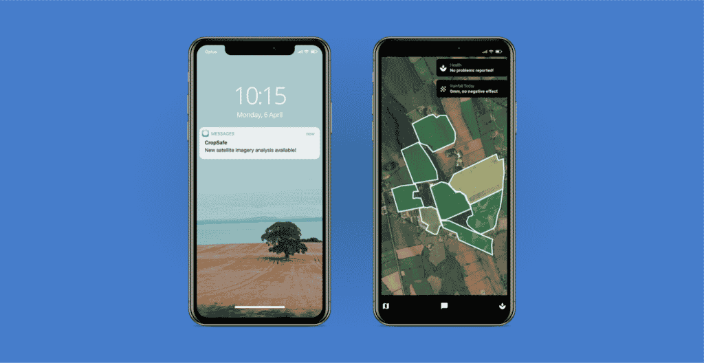
CropSafe is a mobile application that helps farmers monitor the growth of their crops. CropSafe gives farmers information on what is happening in their fields to help them improve their yields, thanks to a combination of up-to-date satellite imagery, sensor data, and machine learning.
The application collects data from a variety of sources, including satellite data and crop health data, and distills it down into simple, actionable insights for farmers. These insights are then sent to CropSafe users via SMS or app notifications, giving them updates on the health of their farms.
In the past, CropSafe has been focusing on farmers in Ireland and the UK but they are currently experiencing growth in the North American market.
How CropSafe uses satellite data
The CropSafe team brings in a lot of satellite imagery from SkyWatch EarthCache, including open, low resolution satellite data, as well as high resolution data from Planet Labs’ PlanetScope and SIIS’ Kompsat-3. Thanks to the SkyWatch platform, all of these data sources are available from the same API endpoint. CropSafe also collects data from additional sources, including data related to healthy, and unhealthy, plant growth and ground sensor data.
By merging all of these datasets together, standardizing them, and feeding the normalized data to their algorithms, the CropSafe team is able to send farmers insights about any inconsistencies they might see within their crops.
Integrating data from multiple sources
The CropSafe team built a variety of processes and tools to integrate these datasets together cohesively in order to accurately predict crop growth for farmers. Rather than waste any more development cycles on importing and getting satellite data ‘analysis-ready’, CropSafe decided to rely on SkyWatch.
According to John McElhone, CEO and co-founder of CropSafe, “using EarthCache sped up our processes quite a lot. We used to order satellite imagery manually. Thanks to EarthCache’s API, our productivity went up 10x.”
Generating a feedback loop
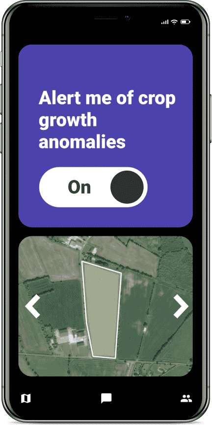
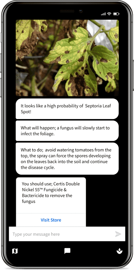
Built into the CropSafe app, is the ability for farmers to take a picture of their crop and send it to the team. Additionally, farmers can request a satellite to be tasked to come and take an updated aerial image of their farm. By integrating with EarthCache, the CropSafe team was able to easily introduce “automated satellite tasking” as a new feature in their application.
By merging information collected for their customers, through on-the-ground pictures of crops, as well as satellite images, the team was able to create a feedback loop to help better identify diseases on crops. As their database of crop information grows, CropSafe is able to provide accurate insights at even faster rates to their customers.
Favourite feature: Archive preview and ‘no minimums’
McElhone acknowledges it was “quite complicated to get satellite data before EarthCache”. Satellite data providers often require customers to purchase a lot of data at once, sometimes more than $10,000 per order. SkyWatch, on the other hand, has no minimum purchase for most datasets, which makes it an ideal solution for start-ups and companies starting with satellite data monitoring.
Another one of McElhone’s favourite features is the option to preview imagery before purchase for high resolution archive data. The CEO mentioned the company in the past had to occasionally send orders back to previous suppliers when the data delivered wasn’t what they needed. Between the extensive filtering options available in EarthCache and the newly rolled-out Archive Preview feature, CropSafe’s development team is extremely pleased with the quality of the data they purchase through EarthCache so far. “I had never seen an Archive Preview feature with commercial imagery before”, commented McElhone.
ABOUT CROPSAFE
Established in Belfast, Ireland
Founded in 2018
Development team size: 5