Get started with our add-in, Satellite Imagery for ArcGIS, in 3 easy steps
Step 1: Create your account
If you already have an EarthCache account, skip to step 3.
EarthCache accounts are free to create. Click the link above to create your account. Check your inbox for an email from the SkyWatch team, and follow the links to create your password and agree to the Terms of Service.
Step 2: Download the add-in
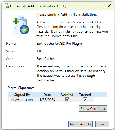
Browse to the folder location of the EarthCache add-in file (*.esriAddInX) that you downloaded on your computer.
Double-click the file to open the Esri ArcGIS Add-In Installation Utility window.
To continue, click Install Add-In. The add-in is copied to the default location and installed. A copy of the file remains in the location where you browsed to it.
If ArcGIS Pro is open, exit and restart the application. The add-in is now available for use.

Step 3: Log in to EarthCache
Return to the add-in. Click Login and sign in with your EarthCache credentials.
Now you can seamlessly search for and acquire imagery, right within ArcGIS Pro.
