Manage geospatial data assets across your entire organization.
HUB gives teams one governed platform to discover, order, control, and share imagery — with budgets, approvals, roles, and spend analytics built in.
- 700+Sensors and data sources
- 25+Integrated data providers
- 1Platform to govern it all
Why HUB
Geospatial data, under one operational framework.
HUB removes the barriers to using geospatial data at scale — no specialized expertise or major software investment required. Give every team access while keeping spend, policy, and security firmly in your control.
Democratize data
Let any team discover and order the imagery they need from a single, intuitive platform — no GIS background required.
Maximize ROI
Streamline spend, prevent duplicate orders, and bring imagery onto one unified operational and financial framework.
Centralized control
Set enterprise-wide policies, budgets, and approvals, with full visibility into expenditure and performance.
Secure sharing
Normalize every order into a standard format and share it securely across your organization with DirectView.
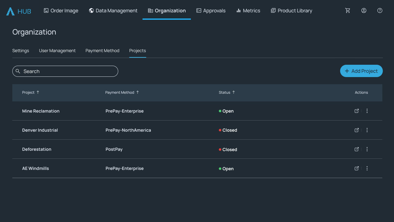
Govern spend with projects and cost controls
Organize work into projects with their own budgets and cost controls, manage prepayments centrally, and watch real-time balances so teams always know what's left to spend before they order.
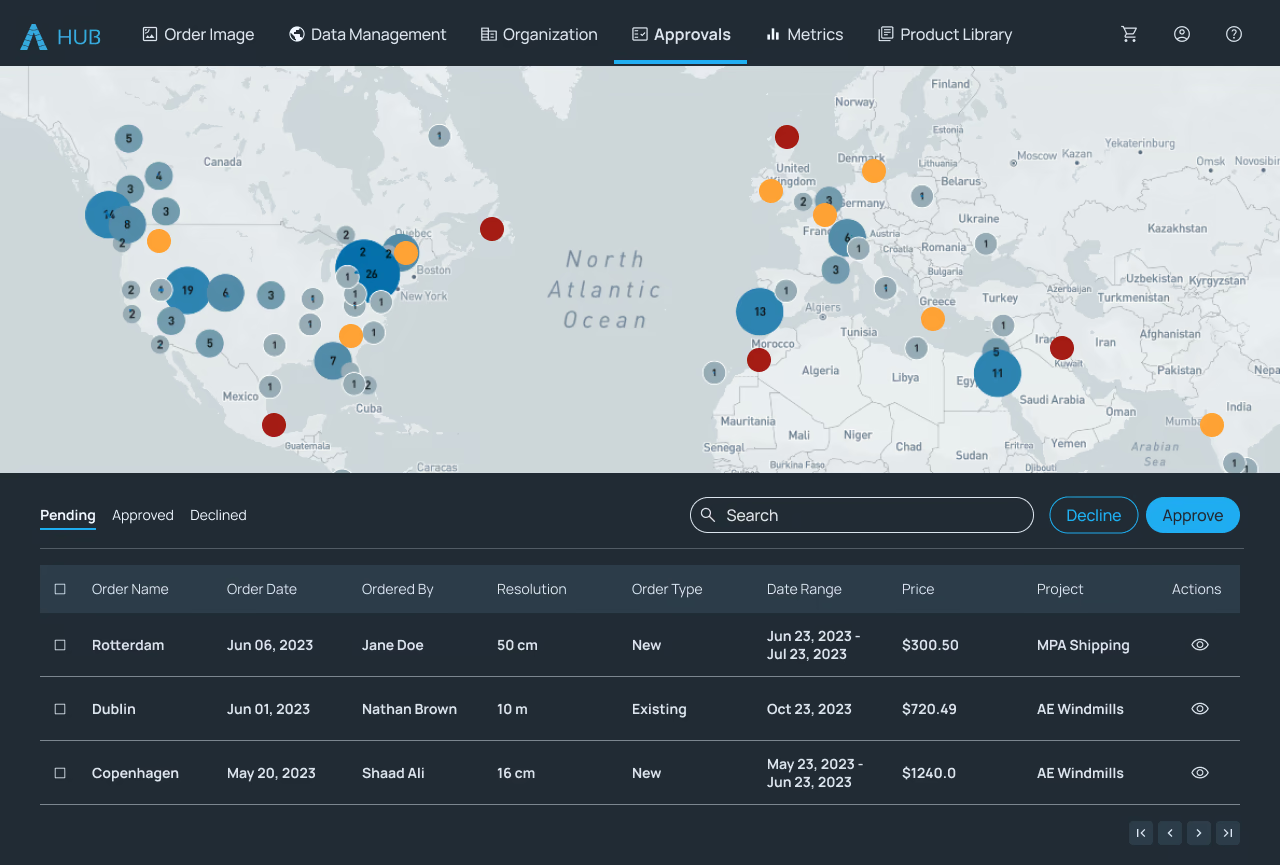
Approve every order before it's placed
A single dashboard shows pending, approved, and declined orders. Review requests with full area and cost detail, and automatically flag duplicate coverage so you never pay twice for the same imagery.
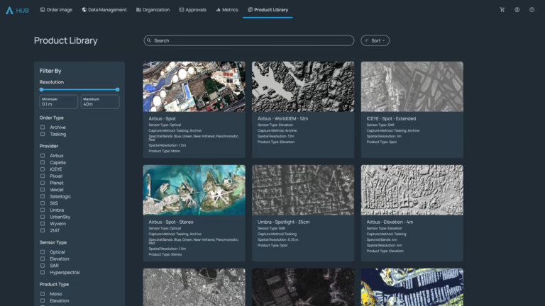
A curated catalog your whole org can order from
Browse a filterable library of on-demand and on-request data sources, each with technical specs and sample imagery — so teams choose the right product with confidence, every time.
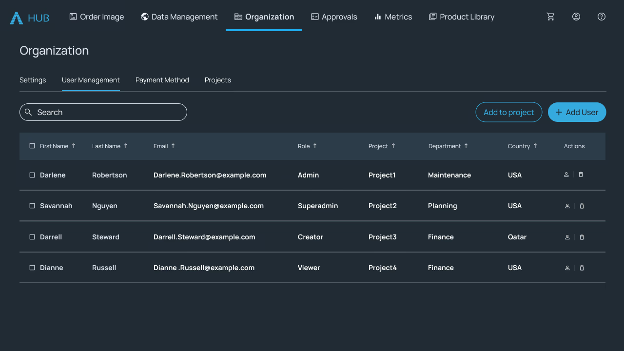
Role-based access for every team
Assign role-based permissions and map users to departments and projects, so the right people can discover, order, and approve — while everything stays aligned to your organization's structure.
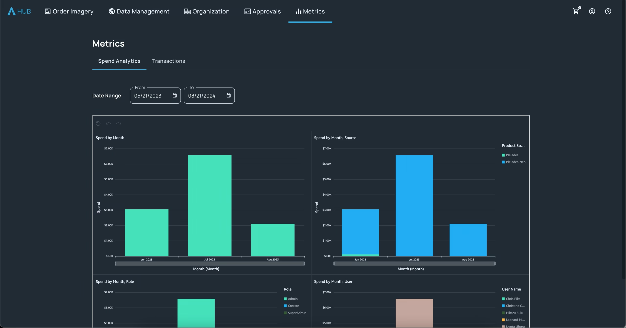
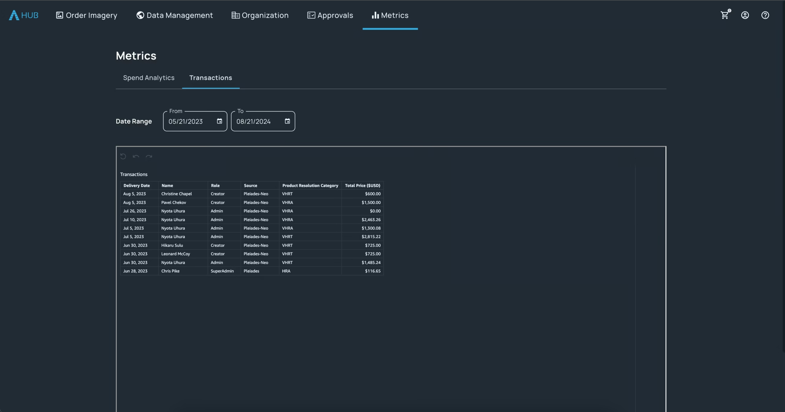
See exactly where your budget goes
Analyze spend by month, source, role, and user, and drill into granular transaction details. Turn geospatial procurement into measurable, defensible ROI for the whole organization.
Data partners
Imagery from the world's leading providers
Give your organization access to an ever-growing network of satellite, aerial, and drone operators — all governed through a single HUB account.


Bring your geospatial data under one roof.
Give every team the imagery they need — with the budgets, approvals, and visibility your organization needs. See how HUB works for your team.