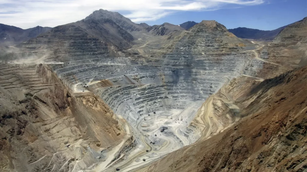
The availability of satellite imagery has revolutionized how we understand what’s happening on our planet.
From helping farmers increase crop yields to assisting in disaster response, the images and data collected from space play an important role in many industries.
One of the industries that has benefited most from the increased availability of satellite imagery—and other types of Earth observation (EO) data—is mining.
The mining industry has made significant advancements in recent years by using satellite imagery for various purposes, such as site monitoring, survey planning, resource exploration, and environmental monitoring.
Here are five ways Earth observation data can improve operations and spur innovation in the mining industry.
Resource exploration
One of the most common applications of satellite imagery in the mining industry is identifying potential areas for resource exploration and mapping the distribution of minerals and other resources within a region.
Resource exploration is done by looking for specific geological features that are known to be associated with particular mineral deposits. For example, certain rock formations often indicate the presence of gold deposits, while others may be more likely to contain iron ore.
By using satellite images to identify these geological features, mine operators can target their exploration activities more efficiently, saving time and money. Satellite imagery also allows geospatial analysts to map the region’s distribution of minerals and other resources. By combining satellite images with other data sources, such as geological surveys, mining companies can better understand a given area’s composition, identify potential areas of interest for exploration or extraction, and optimize their operations by understanding which areas may be already heavily exploited by other operators.
Site mapping
Combine satellite imagery with geospatial applications, such as ArcGIS, to create detailed maps of mining sites, highlighting topography and the location of infrastructure, such as roads and buildings.
Satellite imagery can also be used to identify potential future issues with the proposed site. Mining operators might want to review historical imagery to see how the site has changed over time, and extrapolate these patterns into the future, to identify potential issues, such as topographical shifts that could affect the integrity of the mine structure.
Environmental monitoring
Satellite imagery is an essential tool for monitoring the environmental impacts of mining and managing reclamation efforts.
The use of satellite imagery to monitor environmental impacts associated with the mining industry has increased in recent years, partly because large land areas can be imaged at high resolution at a relatively low cost. There are several ways satellite imagery can be used to monitor the environmental impacts associated with mining, such as assessing the extent of vegetation loss or changes in land use.
Satellite images can also be used to identify sources of pollution, such as acid mine drainage, and track the spread of contamination.
In addition to monitoring environmental impacts, satellite imagery can support reclamation efforts. For example, before and after images can be used to monitor the success of revegetation projects. Satellite images can also assess the long-term stability of mine tailings dams. This information from satellite imagery can be used to improve the sustainability of mining operations and ensure that any negative impacts on the environment are minimized.
Safety monitoring
The mining industry also uses satellite imagery to monitor sites for safety hazards and identify potential risks before they become critical safety issues.
Satellite images can be used to monitor mining sites for various safety hazards. For example, images can be used to identify unstable slopes, which may threaten the integrity of the mine, or the presence of toxic substances. In addition, satellite data can be used to track the progress of safety remediation efforts over time.
Satellite imagery is an essential tool for keeping mine workers and communities safe. By monitoring mining sites for potential hazards, we can take steps to prevent accidents and protect both mining employees and those in surrounding areas from harm.
Production monitoring and forecasting
Satellite imagery can be used to track the progress of mining operations and provide critical insights into production to inform subsequent steps in the supply chain.
For example, operators can use satellite imagery to monitor the day-to-day progress of the mine and track the movement of equipment and activity to improve efficiency and optimize production.
Satellite imagery and data can also be used to monitor the volume of minerals extracted, help operators forecast when sites need to be closed, and plan remediation efforts.

Conclusion
Satellite imagery has become an invaluable resource for the mining industry. It can inform various processes, from identifying mineral deposits to optimizing site operations and planning land reclamation efforts. This technology has revolutionized the way mines are managed and operated.
As satellite imaging evolves, it will become even more helpful in supporting all aspects of the mining industry. By using satellite imagery for resource exploration, survey planning, site mapping, and environmental monitoring, mining companies can better understand the geography of a region and plan and optimize their operations.
Perhaps even most importantly, satellite imagery can be used to monitor safety hazards, and ensure the safety of workers and those in surrounding areas.
In conclusion, satellite imagery is a powerful tool for the mining industry. It can map out potential exploration sites, detect the environmental effects of operations, and monitor land usage changes. By using cutting-edge technology like this, companies in the mining sector can ensure safe and efficient operations that avoid unnecessary risks, while conserving resources.
As new technologies arise, it will be interesting to see how they can further improve our understanding of resource extraction processes and enable more sustainable practices within this important industry.


