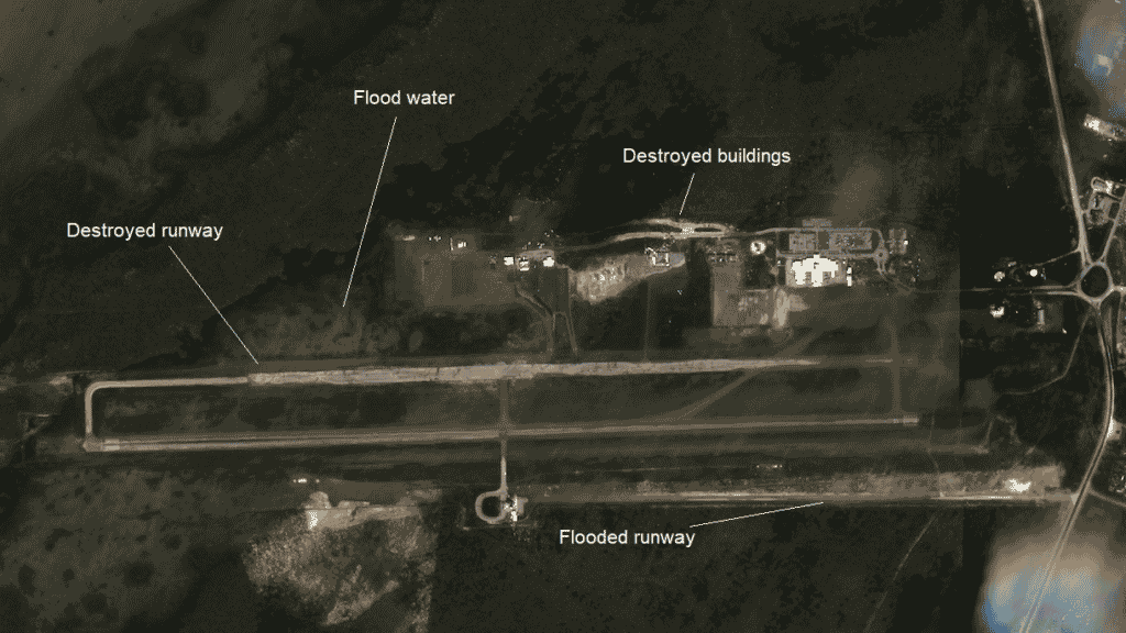
The death toll continues to rise in the Bahamas following the most powerful storm to hit the islands in recorded history. While the Bahamas experience hurricanes frequently, Dorian unprecedented strength caused catastrophic damages that will likely take years to repair. The category 5 hurricane flooded airports, rendered roads inaccessible, damaged homes, hospitals, and businesses, and left more than 7,000 without power.
Volunteers, along with on-the-ground organizations are working around the clock to organize relief efforts for locals and continue searching the debris for trapped survivors. After two days, local groups were able to finally reach the Abaco airport only to find it unusable – a devastating news for the residents of the island who desperately need medical evacuations and emergency supplies.
SkyWatch, along with numerous organizations, is volunteering time and energy to assist with the relief effort. The company is working closely with regional partners, providing them with up-to-date high resolution satellite imagery of hard-to-reach areas to assist with response efforts.
We wish the best of luck to anyone affected by the hurricane. If you believe access to high resolution satellite data can help your relief efforts, please contact us.

Leonard M. Thompson International Airport (Marsh Harbour Airport), Abaco Island, The Bahamas – Taken on September 4, 2019 by Planet Labs (© 2019 Planet. All rights reserved.), extracted and processed by SkyWatch EarthCache™.


