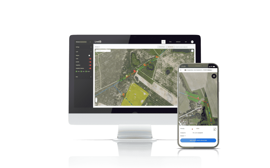
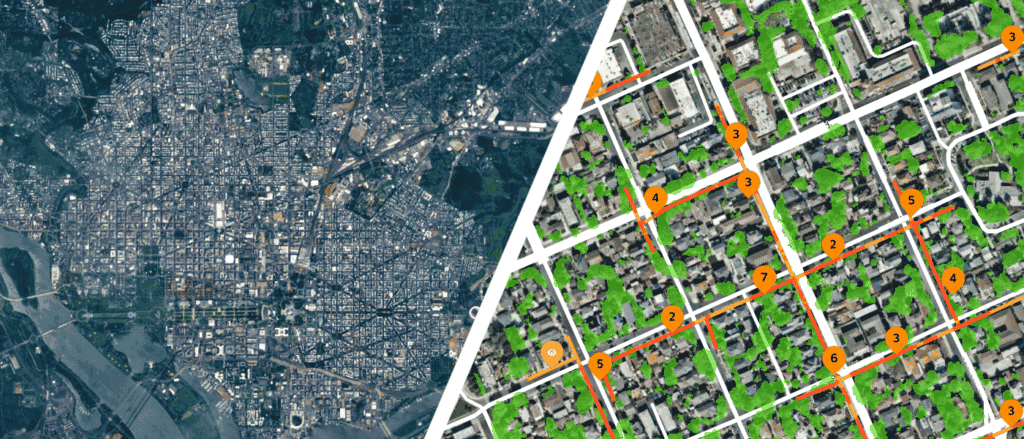
LiveEO uses satellite imagery to provide innovative infrastructure monitoring in the verticals railway, electricity, and pipelines and empowers the operators to save in operational expenses by observing dangers from vegetation, height changes and third party interactions along the network.
How LiveEO uses satellite data
Sven Przywarra, LiveEO’s co-founder explained that the company focuses on generating insights from Earth observation data through artificial intelligence for their customers. Their application is designed as an ‘Information-as-a-Service’ platform for operators of large-scale infrastructure networks, such as electricity, oil and gas, and railways. Sven and his team use a combination of high and medium resolution satellite data to offer cost-efficient asset monitoring over the millions of km2 of pipelines, railways, etc.
Vegetation outgrowth near electricity lines, fallens trees on train tracks, or even people digging too close to buried pipelines can create costly damages to infrastructure. LiveEO monitors assets, searching for external threats, such as vegetation encroachment or third-party interactions, and notify their clients of potential issues, helping operators maintain their network more efficiently.
Thanks to a combination of artificial intelligence and an integration with EarthCache™, which offers on-demand access to high resolution satellite imagery, LiveEO can now update their customers about the health of their infrastructure in less than 48h and for a fraction of what it would cost to send a team on site or commission a plane, a helicopter, or a drone.

We needed API access to the data
“Satellite data is the starting point of everything we do. We translate raw satellite imagery made available for example by EarthCache, analyze it with our machine-learning algorithms, and send the processed geospatial data directly into our web app, mobile app or via our API into the operating systems of our customers”, explained Sven.

“When combined with additional data sources such as digital terrain models (DTM), digital surface models (DSM), weather data, and even proprietary customer data, we can use satellite data for risk prediction and risk modelling for our enterprise clients,” continued Sven. Which is why it was crucial to find an Earth observation data provider with a strong API, to help the developers at LiveEO easily access the data sources they need and quickly integrate them into their workflows.
SkyWatch’s easy EarthCache API saved us a lot of time and effort when we were looking at adding new sources of satellite data into our application, and we are really happy about the simple and efficient design of their interfaces.”
Multiple data sources through one endpoint
“Prior to EarthCache and SkyWatch, we had a hard time getting satellite data from some of the operators directly. Sometimes we couldn’t get a hold of their commercial teams. Sometimes we had issues with their API, making it difficult to get data from one provider, let alone multiple providers, each with a different API. In multiple cases it was easier with EarthCache: one platform, one API, harmonized interface. Now we can focus on building analytics and processing the data rather than how we get the data.”
Sven also mentioned his development team no longer has to worry about contractual obligations and large minimum purchases. With the ability to buy Earth observation data by the km2, a number of business use cases, such as infrastructure monitoring that were previously cost-prohibitive become accessible. “It’s the greatest advantage of your platform,” finished Sven.
Favourite feature: Ease of use.
“Everything is in one place – we can task, we can archive, we can download all of the data”. Sven also mentioned how useful the data preview feature was for the team, especially when it comes to prototyping new offerings. “I think my favourite feature was the ease of use. It was possible to build an integration in a short amount of time.”
ABOUT LIVEEO
Established in Berlin, Germany
Founded in 2016
Development team size: 17 developers


