Leveraging Satellite Imagery For Reforestation
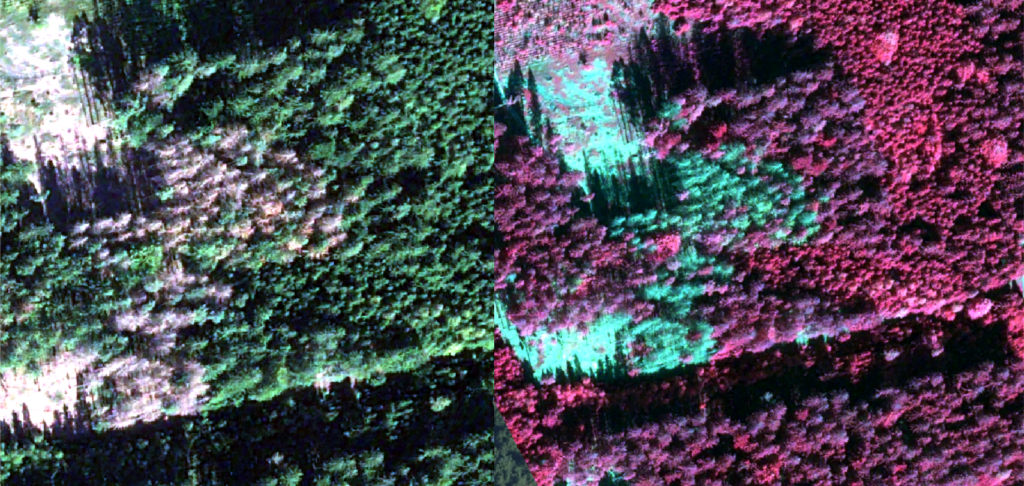
Leveraging satellite imagery for reforestation starts with the act of environmental monitoring. Environmental monitoring often relies on satellite imagery due to its unobtrusive, cost-effective, and consistent analytical capabilities. Land preservation is a common motivation for organizations to practice environmental monitoring and, when it comes to forestry, satellite data has proven to be a valuable tool. […]
How Al Jazeera Leverages Satellite Imagery for Media Analysis

Al Jazeera—which has its own fact-checking agency called Sanad which is committed to investigative journalism, verifying news , and OSINT news stories—recognizes the crucial role of research in providing accurate and comprehensive coverage. There are often limitations on what types of satellite imagery can be acquired and posted publicly, which poses a challenge for many […]
SkyWatch Partners With Pakistan-Based Farmdar

SkyWatch Space Applications Inc. (SkyWatch) announced today its collaboration with Farmdar, an agri-tech company based in Pakistan. Farmdar’s app allows farmers to monitor their land, increase productivity, reduce farming costs, and reduce waste through artificial intelligence (AI) and remote sensing technologies.
Case Study with BAP Intel: From Hobbyist to Professional Analyst

SkyWatch supports not only a wide range of businesses but, in some cases, we even support hobbyists. Benjamin Pittet, founder of BAP Intel in Switzerland launched his career in private intelligence with a blog, X [formerly known as Twitter], and satellite data. Through our EXPLORE App [formerly known as EarthCache], and our amazing satellite imagery […]
How an Intelligence company uses SkyWatch EarthCache

ShadowBreak is an Intelligence consultancy company that focuses on layering data from a variety of sources to provide multi-Intelligence analysis for their military, governmental, and corporate clients. Both their solutions, ReconLink and TacSight, deliver critical insight for decision makers on vital security issues such as regional conflicts, foreign military combat capabilities, general military intelligence assessments […]
How a Precision Agriculture Application Uses SkyWatch EarthCache

CropSafe is a mobile application that helps farmers monitor the growth of their crops. CropSafe gives farmers information on what is happening in their fields to help them improve their yields, thanks to a combination of up-to-date satellite imagery, sensor data, and machine learning. The application collects data from a variety of sources, including satellite […]
Design and Implement Sustainability Strategies With Satellite Data

52impact brings spatial (satellite, aerial, and drone) information to markets who haven’t been using these types of datasets. The company is working with decision makers in industries who haven’t previously worked with geospatial data. The group leans heavily on close customer relations and data visualization to help bridge the gap between the images and the […]
How an infrastructure company uses satellite data

LiveEO uses satellite imagery to provide innovative infrastructure monitoring in the verticals railway, electricity, and pipelines and empowers the operators to save in operational expenses by observing dangers from vegetation, height changes and third party interactions along the network. How LiveEO uses satellite data Sven Przywarra, LiveEO’s co-founder explained that the company focuses on generating […]
How an Artificial Intelligence company uses satellite data

Picterra is a self-serve platform enabling businesses to autonomously extract intelligence & analytics from satellite, aerial, and drone imagery. It comes with a ready-to-use IT infrastructure: in a few clicks, it’s possible to process terabytes of imagery with Picterra’s auto-scaling, GPU-enabled infrastructure. With Picterra, a machine learning model can be built in less than 30 […]
SkyWatch provides Orbital Eye with an efficient alternative to helicopter monitoring

Orbital Eye monitors critical infrastructure, such as oil and gas pipelines, for third-party interferences, such as construction work and excavations. Traditionally, oil and gas companies used helicopters to monitor their pipelines. Orbital Eye was founded with the vision that traditional aerial inspection methods based on helicopters could be replaced by satellite observation. Orbital Eye’s platform, […]