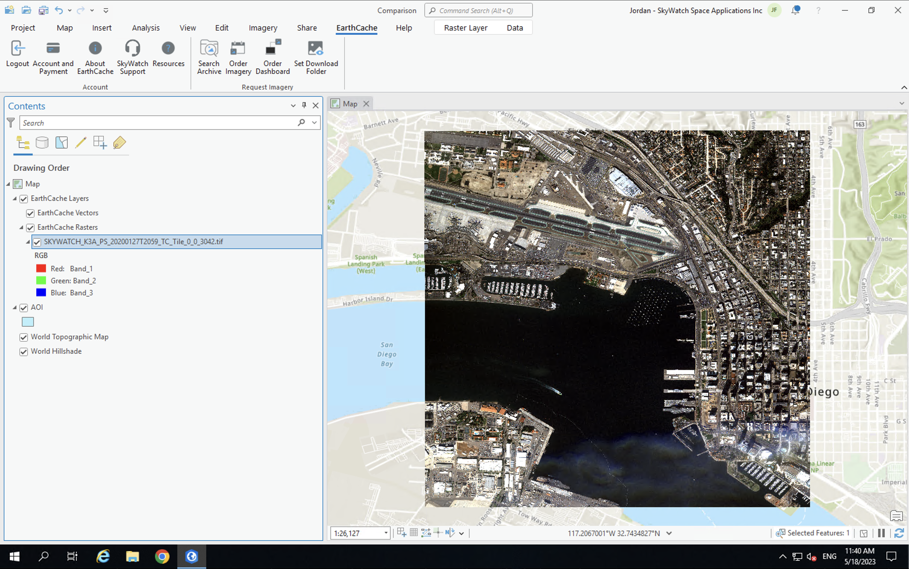
KITCHENER, Ontario, May 30, 2023 (Newswire.com) – SkyWatch Space Applications Inc. (“SkyWatch”), a leader in the remote sensing data technology industry, announced today the availability of EarthCache for ArcGIS Pro. This integration makes SkyWatch’s EarthCache platform, which aggregates data from the world’s leading satellite data providers, available to Esri users within ArcGIS Pro, with one single add-in.

The integration of SkyWatch’s Earth observation (EO) platform, EarthCache, with ArcGIS Pro not only provides a single aggregate source of EO data from the world’s leading satellite and remote sensing operators, but allows users to experience the full capabilities without leaving ArcGIS Pro. SkyWatch’s transparent pay-as-you-go pricing model provides ArcGIS Pro users with the ability to access high-quality satellite imagery directly within ArcGIS, without the requirement to maintain commercial relationships with each data provider. Additionally, ArcGIS Pro users have the flexibility to publish to ArcGIS Online, create tiled basemaps from disparate geo-referenced images, and customize how acquired data is saved, shared, and managed.
“The integration of EarthCache with ArcGIS Pro enables Esri users to more efficiently incorporate satellite imagery into their current workflows,” says David Proulx, Chief Product Officer at SkyWatch. “This integration demonstrates our commitment to making satellite imagery and other types of remote sensing data more accessible. Esri is the global leader in geographic information systems (GIS) technology and location intelligence, and we’re thrilled to partner with Esri to deliver Earth observation data to ArcGIS Pro customers”
The EarthCache for ArcGIS add-in is available now in the Esri ArcGIS Marketplace and at SkyWatch.com.
SkyWatch joined the Esri Partner Network in July 2022.
About SkyWatch
SkyWatch, a space data technology company, is changing the way Earth observation and remote sensing data is managed, distributed and accessed through its data aggregation platform, EarthCache, and its data management and distribution platform, TerraStream. SkyWatch partners with multiple operators and data providers to streamline operations and supply data to geospatial experts and leading organizations looking to bring the power of EO data to their workflows.


