A satellite image became available in 1972 when NASA launched the first Landsat mission. The technology has been used for countless commercial, humanitarian, academic, and personal reasons for the past four decades and has over 100 satellites. So we decided to put together a list of the 5 coolest uses for satellite imagery.
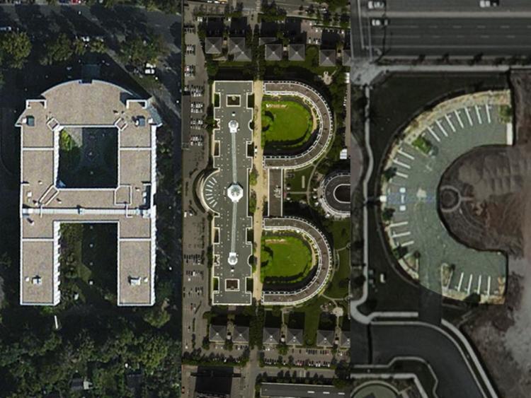
Have you ever explored the world on Google Earth and stumbled upon something that looks like a letter of the English alphabet? This sparked MIT alumni Joey Lee and Benedikt Groß to develop a font only made up of vectors found in satellite imagery called Aerial Bold. As if this wasn’t ambitious enough, they don’t plan to stop there – they hope to create a searchable database of such letters using an algorithm. Consequently, the API for this searchable database could be accessed by other designers, allowing them to utilize any new discoveries when creating or modifying their own alphabets.
4. Taking a Sneak Peek at North Korea’s Elite Family Compounds
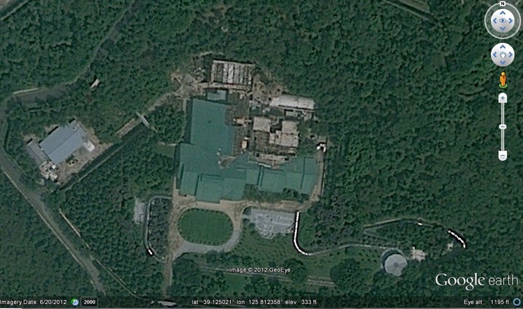
With a country so secretive, satellite imagery has offered outsiders an insight into the high living of North Korea’s premier family. East of Pyongyang stands Ryongsong Residence – the home of Supreme Leader Kim Jong-un. This compound was built by his grandfather, Kim Il-Sung, in 1983 and is kitted out with amenities to rival any five-star complex -including an Olympic-sized pool with a waterslide, a man-made lake, stables for horse riding and, last but not least – its own railway line connecting it to Pyongyang. BBC sources inside North Korea have confirmed that this very residence served as the main home of Kim Jong-Il before his death in 2011. The images accessed through satellite allow onlookers to view the major gap between the elites and their general population. You can also see these epic snapshots on Google Maps (be aware that images of Kyongsong may be conspicuously blurred).
3. Becoming a Space Archaeologist
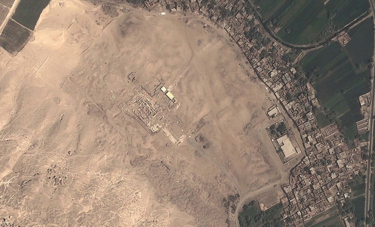
Sarah Parcak, the 2016 TED Prize winner, is trying to unearth the world’s hidden history using satellite imagery. Considering herself a space archaeologist, Parcak wants everyone to join her in this endeavour. Her goal is to rely on the public to study satellite photography and uncover clues that point to historical artifacts and activities. To do this, she has built Global Xplorer – a platform for amateur space archaeologists. Its imagery will encompass both the visible light spectrum and infrared spectra; users will be asked to look for vegetation changes that could indicate man-made structures underneath. Through Global Xplorer, Parcak seeks to revolutionize modern exploration – though her major ambition remains launching her archaeology-dedicated satellite – by creating a network of remote sensing analysts.
2. Responding to Refugee Crises
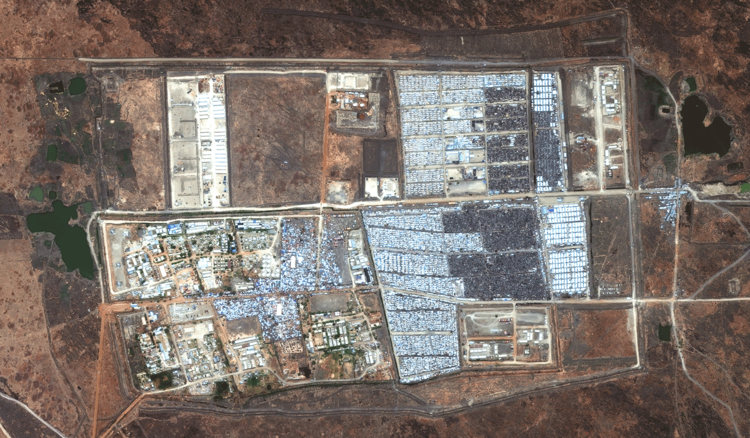
In 2014, South Sudan experienced its most severe food shortage on record, which led to a civil war and caused more than one million of its citizens to abandon their homes and seek refuge in refugee camps supported by international organizations such as the United Nations. The size of these settlements grew rapidly, raising the difficulty in preparing to supply necessary goods like food and shelter. Aerial imagery supplied by satellites proved extremely useful for this purpose but also gained utility in other ways: the UN could track human displacement and anticipate regions prone to future disputes. Earlier this year, satellite imaging played an essential role in tracing approximately 38,000 people from South Sudan during another conflict. The UN is prepared to provide immediate assistance upon arriving at a destination with the potential for another food crisis.
1. Tracking Down a Long-Lost Home
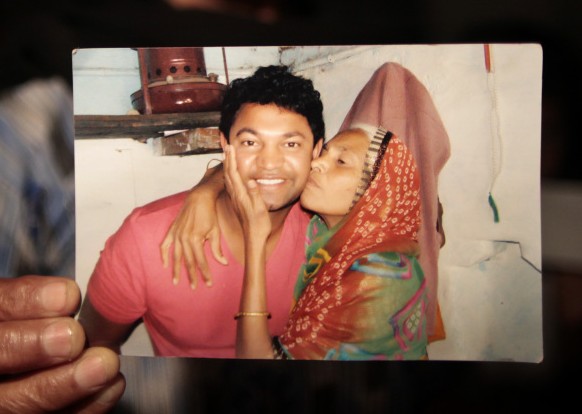
In 1986, Saroo Brierley, a 5-year-old, fell asleep while he was meant to meet his brother at a station. He woke hours later on a train, far from home and without any idea how to get back. Three weeks passed before he was taken in by an orphanage and eventually adopted by an Australian couple who raised him in Tasmania until he was 30. With only his parents’ names as clues, Brierley searched for his old home for many years. After analyzing thousands of bird’s eye photos of the area surrounding Calcutta, he finally identified the village of Khandwa thanks to a familiar waterfall he remembered from childhood. He immediately went there and met his mother soon afterwards – 25 years after his initial disappearance.
Since the first satellite photograph of Earth was taken more than half a century ago, satellite imagery has come a long way. As higher resolutions become available to the public, more opportunities for cool use cases open up. Let us know if you’re interested in using satellite imagery to solve a unique problem.


