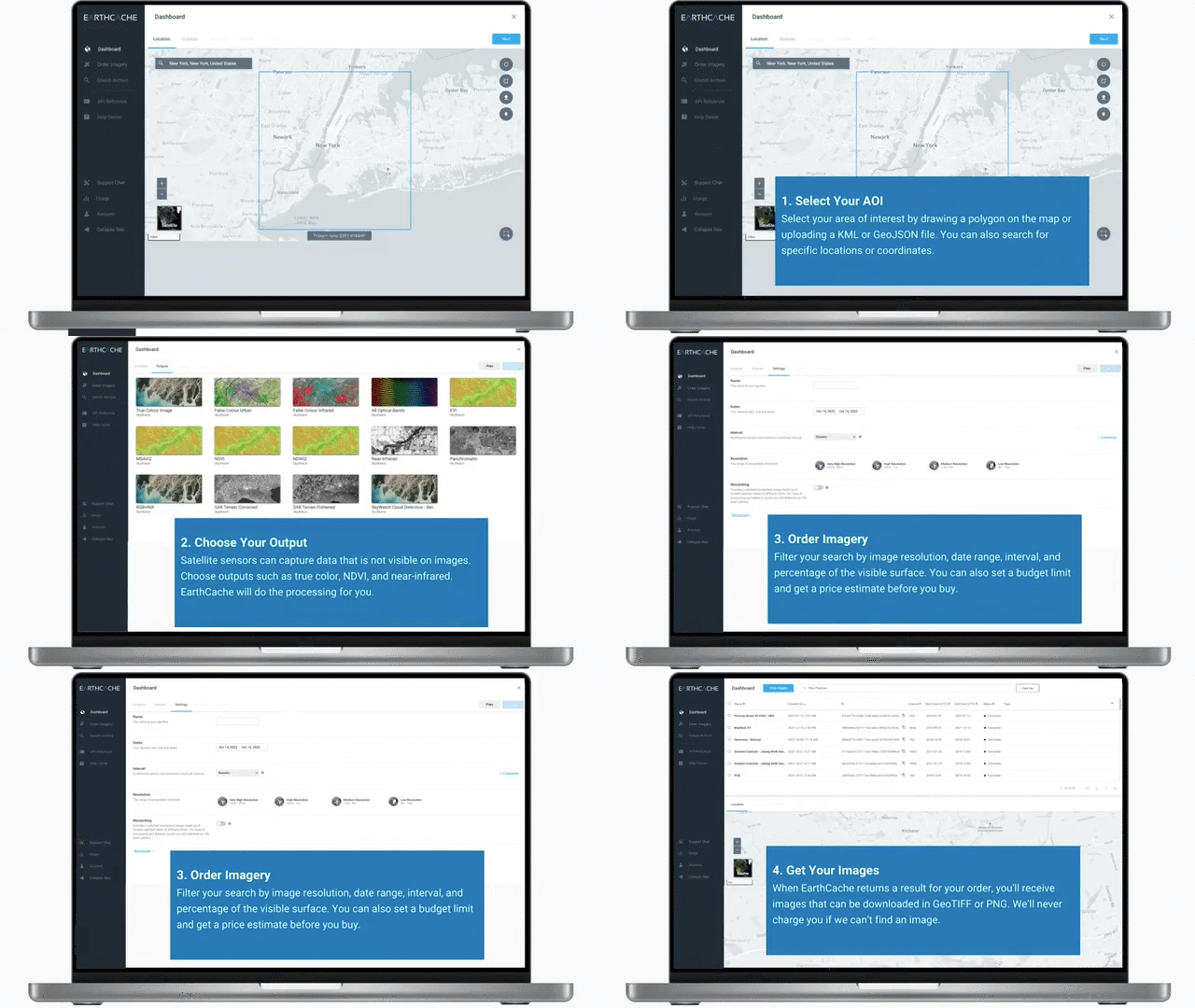
AOI is an acronym for “Area of Interest.”
Knowing your desired AOI will help you in planning your data collection with satellites to ensure you get the right technology in the right place and at the right time.
In EarthCache, this describes the location for which you are ordering satellite imagery.
In geospatial terms, there are three ways of describing locations. These are points, lines, and polygons. A point is a pair of GPS coordinates, a line is a set of these coordinates, forming a line on the Earth’s surface, and a polygon is a set of coordinates that makes a closed shape.
Whether tasked or archived, you need to outline a location on the earth when ordering satellite data through a marketplace console like SkyWatch’s EarthCache.
Selecting an AOI can be done with the following methods:
- GPS coordinates
- Manually draw the AOI using the polygon tool.
- Upload a KML or GeoJSON file


