Real-time satellite data is one of the most common questions our customers ask — and one of the most misunderstood. The phrase suggests a live video feed of any point on Earth, available the instant you ask for it. The reality is more nuanced, and more interesting.
As with most high-quality data feeds, the limits on how quickly imagery refreshes come down to transfer speeds and processing speeds. In the best case, only a few minutes pass between capture and delivery. For high-resolution imagery, though, it more often takes a few days.
There are a finite number of Earth observation satellites, and they aren’t always within range of a downlink station. They also don’t capture data continuously. Each day, satellites collect hundreds of terabytes of imagery, which is stored onboard until the satellite passes a downlink station. There, the data is decoded, sent to the provider, processed further, and finally delivered to the customer.
Capturing and shipping space data once took weeks. Today the commercial space industry is booming. As computing costs fall, space data is moving to the cloud, companies such as SkyWatch are automating satellite data access, and new entrants are getting into the game. The time between capturing a scene and delivering high-resolution data to a customer is steadily dropping from days toward minutes.
So why don’t the live, real-time satellite video feeds you see in Hollywood films exist yet? Let’s break it down.
How Many Satellites Are Watching Us Right Now?
There are two main types of Earth observation satellites: those in geosynchronous equatorial orbit (GEO) and those in low Earth orbit (LEO).
GEO Satellites: Constant View, Low Detail
GEO satellites are geostationary. They orbit at the same speed Earth rotates, so they stay fixed above the same spot. To hold that position, they sit at an altitude of roughly 35,786 km (22,236 mi).
Because they never move out of range of a reception dish, they can transmit data as they capture it. But that distance limits detail — cities appear as broad areas rather than sharp features. As a result, GEO satellites are used mostly for weather observation and are considered very low resolution.
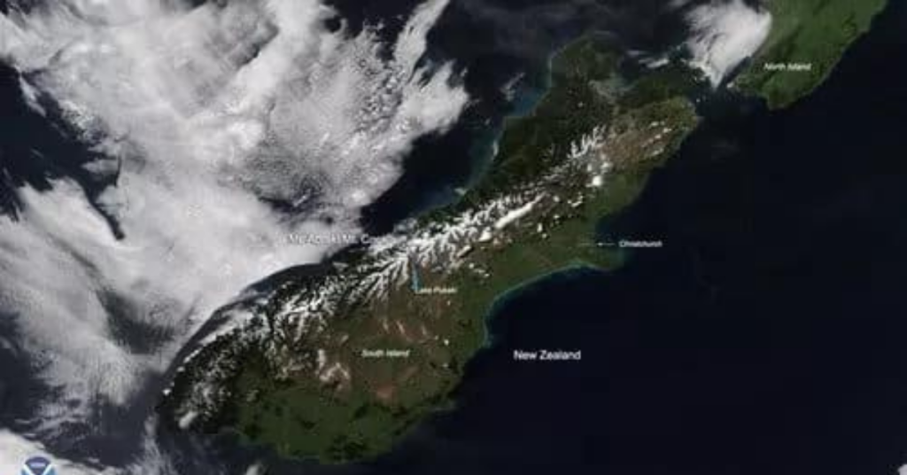
Here is an example of GEO satellite data: a view of New Zealand’s Southern Alps with fresh snow cover, captured by NOAA-20 on Nov. 3, 2019.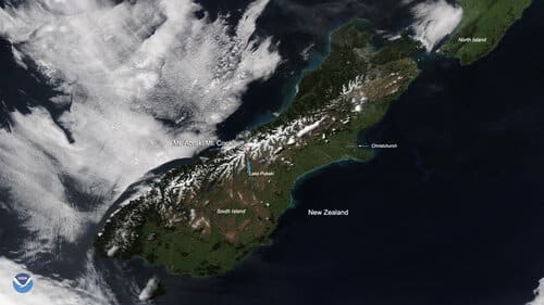
LEO Satellites: Sharp Detail, One Strip at a Time
Most people expect satellite imagery to look like a zoomed-in view on Google Maps. In practice, aerial photography usually provides the highest available zoom. The sharpest commercial optical satellite data available today is 30 cm per pixel — roughly a 12-by-12-inch area on the ground under ideal conditions.
LEO satellites capture these sharper images. They cover the globe one strip at a time, traveling pole to pole, with most polar-orbiting satellites returning to the same pole about every 90 minutes. As Earth rotates beneath the satellite, each new strip covers a different area.
Satellites face a trade-off: they can capture a few wide, low-resolution images in fewer passes, or many narrow, high-resolution images over a longer period.
A wide-coverage satellite like MODIS, with a 2,300 km (1,400 mi) swath, can image the entire globe in one to two days at 250 m (820 ft) resolution. By contrast, a single Sentinel-2 satellite, covering 290 km (180 mi) at 10 m (33 ft) resolution, takes 10 days to revisit the same area at the same viewing angle. With both Sentinel-2 satellites (S2A and S2B), that revisit time drops to five days.
To improve refresh rates, operators launch multiple satellites carrying the same sensor into the same orbit — a technique called “pearling.” It’s how operators like Planet can give SkyWatch and other partners daily medium- and high-resolution coverage of the same area. With a constellation of several hundred satellites, Planet can image the entire globe every day.
How Long Between Capture and Delivery?
Delays happen mainly when a satellite is out of range of a downlink station, which can last several hours.
Polar-orbiting satellites travel at about 7.8 km/s (4.8 mi/s). When passing over a downlink station, they’re in range for less than 10 minutes — and in that window they must transmit everything collected since the last pass. Operators have to make sure they never capture more data than they can downlink in a single pass, while also managing downlink and processing costs.
Because of this, many operators capture only “interesting” scenes rather than imaging the whole planet continuously, unless a client requests it. Tasking data also tends to cost more than archive data, because operators must update their collection schedules to accommodate specific clients.
To guarantee imagery of your area of interest, it’s best to task a satellite to capture it rather than wait for archive data to appear. Platforms like SkyWatch can automatically place tasking orders for your application — a good option when you need data collected within a week.
How Long Does It Take to Process Satellite Data?
The data a satellite captures looks very different from what you’d see in Google Earth.
The station receiving the raw data (known as “level 0”) decodes it and transforms it into usable imagery, adding geotagging, timing, and sensor information. This first step alone can take from a few minutes to an hour before the data reaches the provider.
From there, the imagery is often refined into analysis-ready data (ARD). This stage sharpens the image, applies atmospheric correction, and smooths out distortions caused by the sensor’s viewing angle. It’s increasingly automated, because manual processing can add days to delivery.
Finally, the ARD is stored online and made available. On automated distribution platforms like SkyWatch, this last step takes only a few minutes.
SkyWatch’s advances in automating EO data capture and distribution — including in-flight preprocessing, cloud storage, and automated ordering of both archive and future imagery — are pushing the gap between capture and high-resolution delivery from days toward minutes.
Get Faster Access to Satellite Data
If you want to automate access to low-, medium-, and high-resolution satellite data, start browsing imagery. If you prefer to work only with open, free imagery, check out our roundup of free sources of satellite data.