Open Data
Unlock global insights with open data
Get up-to-date free satellite imagery and open data through the SkyWatch platform. Instantly access and download the latest imagery for mining, government, energy, and construction projects — all in one intuitive platform. Empower your decision-making with powerful, accessible insight at zero cost.
- FreeOpen data at zero cost
- 10mSentinel-2 resolution
- GlobalComplete planetary coverage
Open data
The easiest way to access open data
Easily access free satellite imagery through one streamlined platform. Monitor changes, manage large-scale projects, and improve safety — with no hidden costs and no hassle.
Simple to use
Our intuitive web platform makes finding and downloading imagery straightforward for users of all skill levels.
Total transparency
What you see is what you get. We provide clear information on data sources and capabilities.
Frequently updated
Stay current with imagery updated globally on a regular basis, ensuring your insights are timely and relevant.
Cost-effective
Access priceless data for planning, monitoring, and compliance at zero cost to your budget.
The colour vision of Copernicus
Part of the EU's Copernicus programme, ESA's Sentinel-2 mission is a cornerstone of our free imagery offering. A constellation of twin satellites (Sentinel-2A, 2B, and 2C) carries a multispectral imager with 13 spectral bands at up to 10m resolution, a wide 290km swath, and a 5-day global revisit — ideal for vegetation health, agriculture, land-cover classification, and disaster mapping.

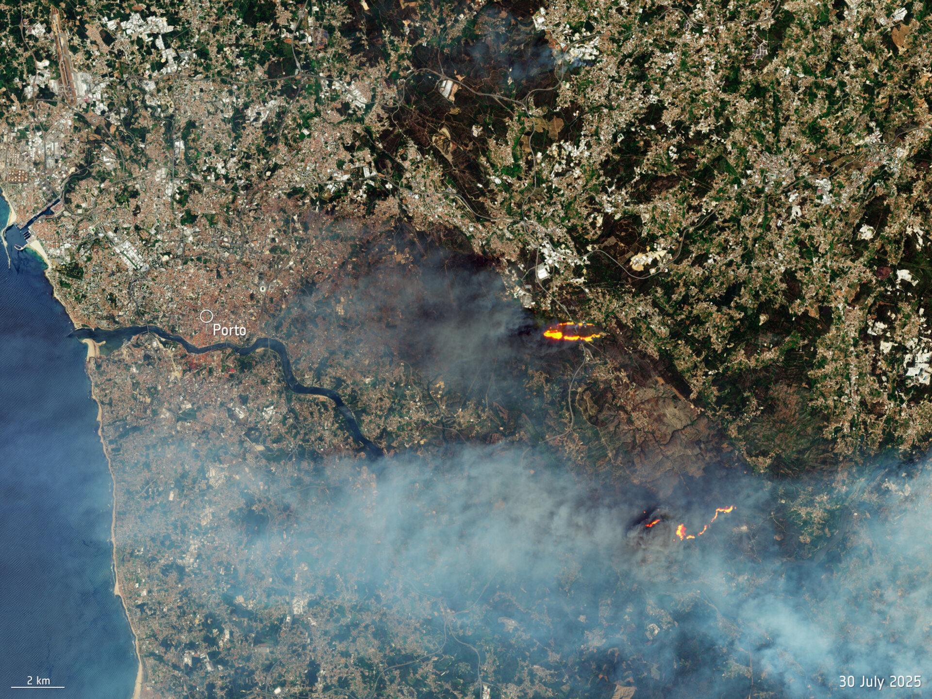
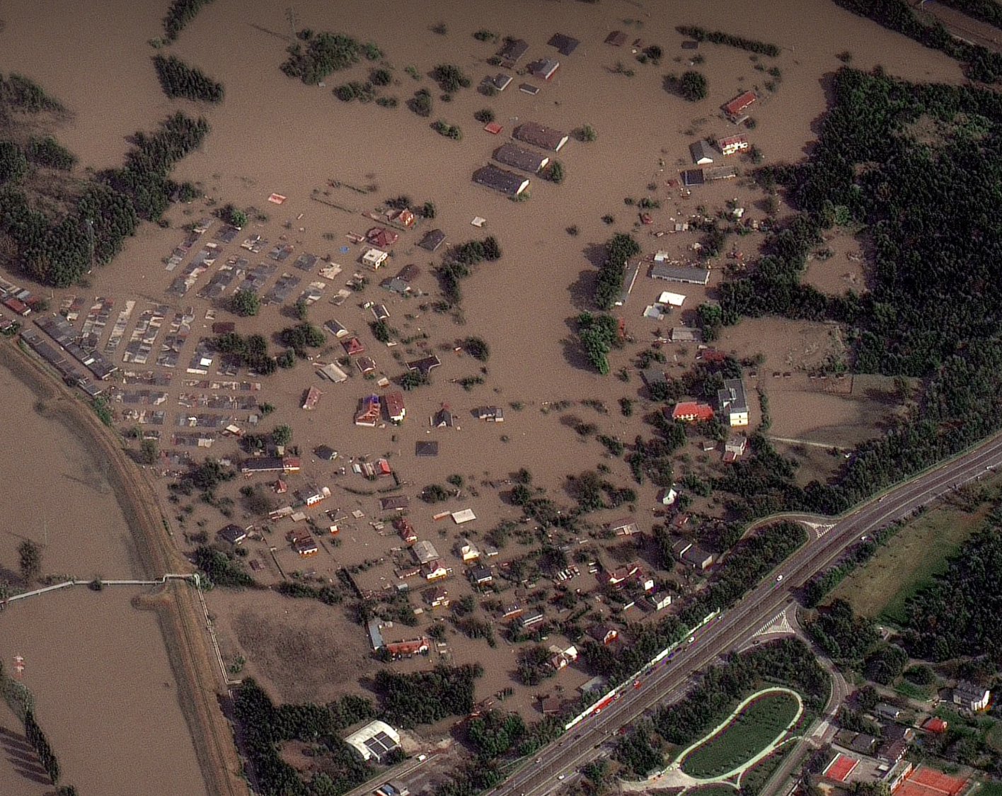
Imagery for disaster response
The Vantor Open Data Program makes near real-time satellite imagery available to first responders and humanitarian organizations to assist with disaster relief.
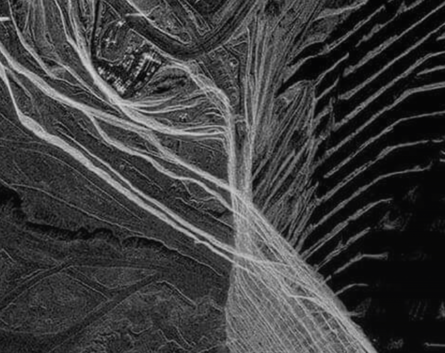
Free SAR for change monitoring
The Umbra Open Data Program monitors over 20 global locations and makes Synthetic Aperture Radar (SAR) data available at no cost — penetrating cloud and darkness for persistent change monitoring.
Use cases
Putting free satellite imagery to work
Boost efficiency, safety, and compliance with free satellite imagery — enabling smarter, faster decisions and optimized project management, at no cost.
Monitor broad areas
Track changes across large project sites, environmental zones, or municipal areas.
Enhance project planning
Use up-to-date imagery to inform site selection, infrastructure planning, and resource allocation.
Improve situational awareness
Gain a clear view of remote assets or areas affected by natural events to coordinate response efforts.
Support compliance
Use historical and current imagery to document site conditions and adhere to environmental regulations.
Getting started
Getting started is easy
Transform complex satellite data into clear, actionable insights — fast and hassle-free.
Explore the globe
Navigate to our platform and begin exploring open data immediately. No complex signup is required to start your search.
Define your area
Select your area of interest and browse the available free imagery from our integrated open data sources.
Download your data
Select the images you need and download them directly to integrate into your existing workflows and tools.
Data partners
Imagery from leading providers
Free and open imagery from public missions and partner programs.


Start exploring open data today
Transform complex satellite data into clear, actionable insights — fast, hassle-free, and at zero cost.