Architecture, Engineering & Construction
Monitor construction and infrastructure projects without field delays
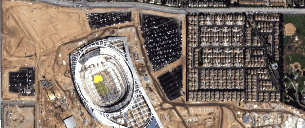
Construction and infrastructure projects move fast, span large sites, and carry real risk when something slips. Site visits are costly and periodic, progress data is fragmented, and by the time an issue surfaces it has already hit the budget or the schedule. SkyWatch gives AEC teams continuous visual visibility into every site — from feasibility through handover — without sending anyone into the field.

The platform
A unified platform for project monitoring
SkyWatch gives AEC teams a single place to discover, buy, manage, and integrate geospatial data — no specialized expertise or multiple vendors required.
Discover imagery across providers
Access satellite, aerial, and (soon) drone imagery from a growing ecosystem of providers — without managing multiple vendors.
Purchase and task new data on demand
Order imagery when and where you need it, with transparent pricing and flexible tasking options.
Centralize and manage your imagery
Keep historical and current data organized, accessible, and ready for analysis across teams.
Integrate into your existing workflows
Use imagery directly in GIS platforms like ArcGIS, internal dashboards and analytics tools, and automated monitoring systems via API.
Plan your site more accurately
Assess potential sites remotely, run feasibility studies, and optimize your build before breaking ground.
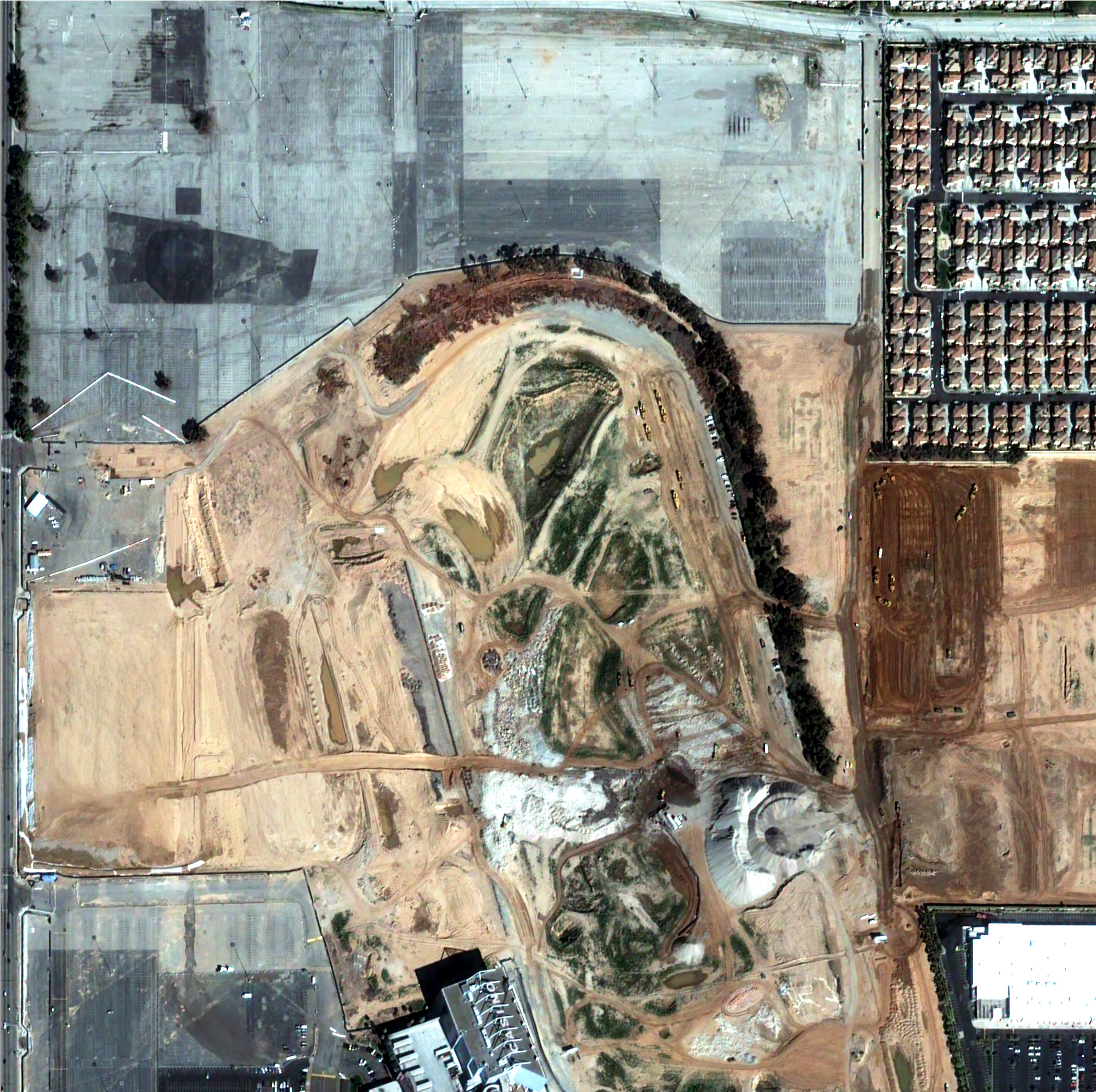
Monitor progress as it happens
Track construction progress and catch setbacks early to protect project budgets and schedules.
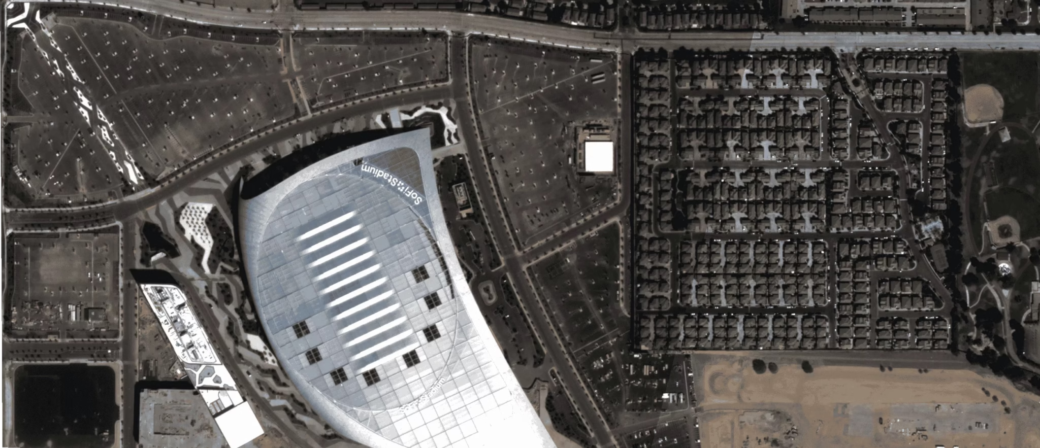
Protect the finished asset
Continually monitor and assess risks to structures and the surrounding area long after handover.
Use cases
Use cases for AEC teams
Put satellite, aerial, and drone imagery to work across the workflows that matter most to your team.
Site selection & feasibility
Assess potential sites remotely, evaluate terrain and access, and run feasibility studies before committing crews and capital.
Progress monitoring
Track construction progress over time and catch schedule slippage early with regular, comparable imagery.
Change detection
Detect changes on and around your site — earthworks, encroachment, and environmental factors that may affect the build.
Site safety & inspection
Inspect sites and surrounding areas remotely to reduce human error and keep crews out of hazardous conditions.
As-built & post-construction
Maintain a visual record of the finished asset and monitor risks to structures and the surrounding area after handover.
Why SkyWatch
Why AEC teams choose SkyWatch
- Faster, better-informed planning decisions
- Reduced site-visit and inspection costs
- Fewer schedule and budget surprises
- A defensible visual record for stakeholders and compliance
- Scalable monitoring across multiple sites and regions
Built for your team
Built for how your team works
Whether you're a GIS analyst, an operations lead, a data engineer, or an executive — SkyWatch fits into your workflow, not the other way around.
GIS analysts
Working in ArcGIS and other GIS platforms, pulling imagery straight into existing projects.
Operations teams
Monitoring distributed assets day to day and acting on change as it happens.
Data & engineering teams
Building internal tools and automated monitoring on top of the API.
Executives & decision-makers
Who need clearer, faster visibility across the whole organization.
Data partners
Imagery from the world's leading providers
Access an ever-growing network of satellite, aerial, and drone operators — all through a single SkyWatch account.


Build with a clear view of every site
From feasibility to handover, give your team the imagery to plan accurately, monitor progress, and manage risk — all from the desktop.