Aerial Imagery
Focus on precision with aerial imagery
Aerial imagery bridges the gap between ground-level surveys and satellite views, offering a level of clarity and perspective essential for precise decision-making. By capturing images from aircraft flying at lower altitudes, this technology delivers resolution as fine as 7.5 cm, revealing the details of your project site, city, or asset — transforming how organizations plan, monitor, and manage their operations.
- From 7.5 cmGround resolution
- RapidTurnaround after collection
- 3DModeling and elevation ready
Why aerial
Key benefits of aerial imagery
Captured by sophisticated camera systems on manned aircraft, aerial imagery allows flexible flight paths and capture under specific conditions — giving you the exact visual data you need, when you need it.
Rapid turnaround
Receive up-to-date aerial imagery quickly after collection, enabling faster project updates and timely decision-making.
Superior resolution
Obtain ultra-sharp images that let you see fine details like road markings, utility lines, and vegetation types.
Enables 3D modeling
Leverage overlapping imagery to create precise 3D models and digital elevation maps for depth analysis and volumetric measurement.
Geometric accuracy
Rely on orthorectified imagery that corrects for terrain distortion — perfect for engineering and survey-grade measurements.
Survey-grade orthomosaics from the sky
Manned aircraft equipped with high-resolution sensors fly over your area of interest, capturing overlapping images that are processed into orthomosaics — seamless, geometrically corrected maps with high positional accuracy. Flying closer to the ground than satellites, they often distinguish features as small as a few inches.
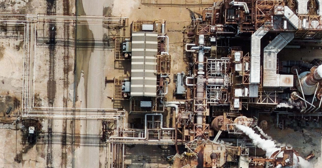
Inspect assets in fine detail
Aerial imagery enables close monitoring of pipelines, refineries, transmission corridors, and other critical infrastructure — helping teams identify corrosion, leaks, or encroachment risks before they become costly failures.
Applications
Applications across industries
Aerial imagery is a cornerstone for industries that require precision and detail, providing accurate, high-fidelity visual data for project management and operational planning.
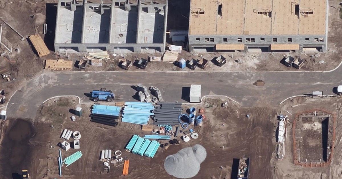
Architecture, Engineering & Construction
Streamline the project lifecycle with precise site surveys and progress monitoring. Overlay designs onto real-world conditions, track daily progress, verify earthwork volumes, and ensure site safety without constant field visits.
Energy, Oil & Gas
Maintain the integrity of critical infrastructure with detailed visual inspections of pipelines, refineries, and transmission corridors — identifying risks before they become costly failures.
Insurance
Assess property conditions and storm or disaster damage remotely, verify claims, and model risk with up-to-date, high-fidelity imagery — reducing manual inspections.
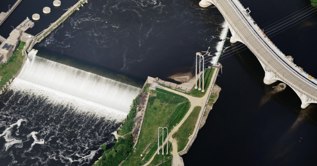
State & Local Government
Enhance urban planning and tax assessment with up-to-date visual records — updating GIS databases, planning zoning changes, managing stormwater billing, and assessing property improvements.
Utilities
Monitor vegetation growth near power lines and inspect remote assets, planning vegetation-management cycles effectively to reduce outage risks and maintenance costs.
Data partners
Imagery from leading providers
Survey-grade aerial imagery from leading aerial providers.
Gain a clearer picture of your operations
When precision is non-negotiable, aerial data delivers the detail you need. Equip your team with high-fidelity visual data to drive accuracy and efficiency in every project. Weighing your options? See how aerial compares in satellite vs. aerial vs. drone imagery.