Satellite Imagery
Make better decisions with satellite imagery
Satellite imagery gives organizations an objective, up-to-date view of any location on Earth — from a single construction site to an entire region. SkyWatch brings imagery from the world's leading providers into one platform, so you can find, buy, and use the data you need without juggling separate vendor contracts.
- 700+Sensors and data sources
- Down to 15 cmHighest available satellite resolution
- GlobalCoverage of any location on Earth
The basics
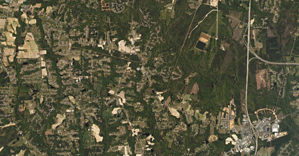
What is satellite imagery?
Satellite imagery is created by sensors mounted on satellites orbiting the Earth. Those sensors detect energy reflected from the planet's surface across many parts of the light spectrum — including bands invisible to the human eye — and that data is processed into detailed, geolocated images.
The result is a clear, current view of locations that would be costly, slow, or impossible to reach on the ground. Whether you are tracking a project, monitoring remote assets, or verifying conditions on the ground, satellite imagery turns hard-to-reach places into measurable, shareable insight.
Satellite is one of several ways to capture a site from above — see how it stacks up against other platforms in satellite vs. aerial vs. drone imagery.
How it works
How satellite imagery is captured
Satellites follow set orbital paths, systematically scanning the surface below. From orbit to analysis-ready data happens in four stages.
Satellites orbit
Sensors follow set orbital paths over Earth, systematically scanning the surface below.
Sensors capture
They record energy across visible, near-infrared, and other spectral bands — including light invisible to the eye.
Data downlinked
The captured data is transmitted to ground stations as the satellite passes overhead.
Processed imagery
It's processed and delivered as analysis-ready images that reveal detail and change over time.
The path from orbit to analysis-ready satellite imagery.
Why satellite
Benefits of satellite imagery
Satellite imagery is a versatile tool that drives innovation and efficiency across sectors. Its large-scale, objective view of any location on Earth makes it indispensable for modern operations.
Global coverage
Reach any location on Earth, from remote mountain ranges to dense urban centers, using commercial imagery or open data.
High-resolution detail
See fine features on the ground for precise analysis and verification.
Consistent monitoring
Track change across days, months, or years with regularly updated captures.
Objective data
Gain an unbiased, time-stamped record to support critical decisions.
Data partners
Satellite imagery providers in one place
SkyWatch aggregates data from many leading commercial and government providers — including Airbus, Vantor (formerly Maxar), Planet, BlackSky, Capella Space, ICEYE, and more — alongside open data. Instead of negotiating with each operator, you compare options and purchase from a single platform. New to the landscape? See our overview of satellite imagery companies to compare the major operators.


Applications
Applications across industries
Satellite imagery is a versatile tool that drives efficiency across sectors that depend on accurate, large-scale, objective data.
Architecture, Engineering & Construction
Site surveys, project planning, and progress monitoring. Assess terrain, track development, and manage assets to improve decisions and reduce costs.
Energy, Oil & Gas
Infrastructure monitoring, exploration, and environmental compliance. Detect pipeline routes, assess land use, and monitor remote sites from your desk.
Mining & Natural Resources
Exploration, site analysis, and operational safety. High-resolution imagery reveals land changes, output, and environmental impact.
State & Local Government
Land management, urban planning, and disaster response — timely data for informed decisions that benefit communities.
Utilities
Asset management, vegetation monitoring, and infrastructure maintenance — identify risks, track network conditions, and plan repairs.
Unlock the power of satellite imagery
Whether you're managing resources, planning ahead, or responding to immediate challenges, satellite data provides the insight you need to act with confidence.
Ready to start? Buy imagery in EXPLORE, or review satellite imagery pricing and how to buy satellite imagery before you order.