The world's largest inventory of geospatial data, in one simple application.
Search, preview, and buy archive or freshly tasked satellite, aerial, and drone imagery from 700+ sensors — without contracts or commercial negotiations.

- 700+Sensors and data sources
- 25+Leading data providers
- $0Contracts or minimums to start
Why EXPLORE
Skip the quotes. Find and buy in minutes.
Buying imagery used to mean chasing quotes across a dozen providers. EXPLORE puts the whole market in a single, intuitive platform — so you find the right data and know the price before you commit.
One platform, every provider
Discover and purchase archive or tasked data from the world's leading providers in one user-friendly interface — no more juggling vendors.
Budget-friendly minimums
We've partnered with data providers to lower minimum area requirements, so you buy only the coverage you actually need.
Normalized, transparent pricing
Pricing is standardized across providers, eliminating the need to negotiate commercial terms for every order.
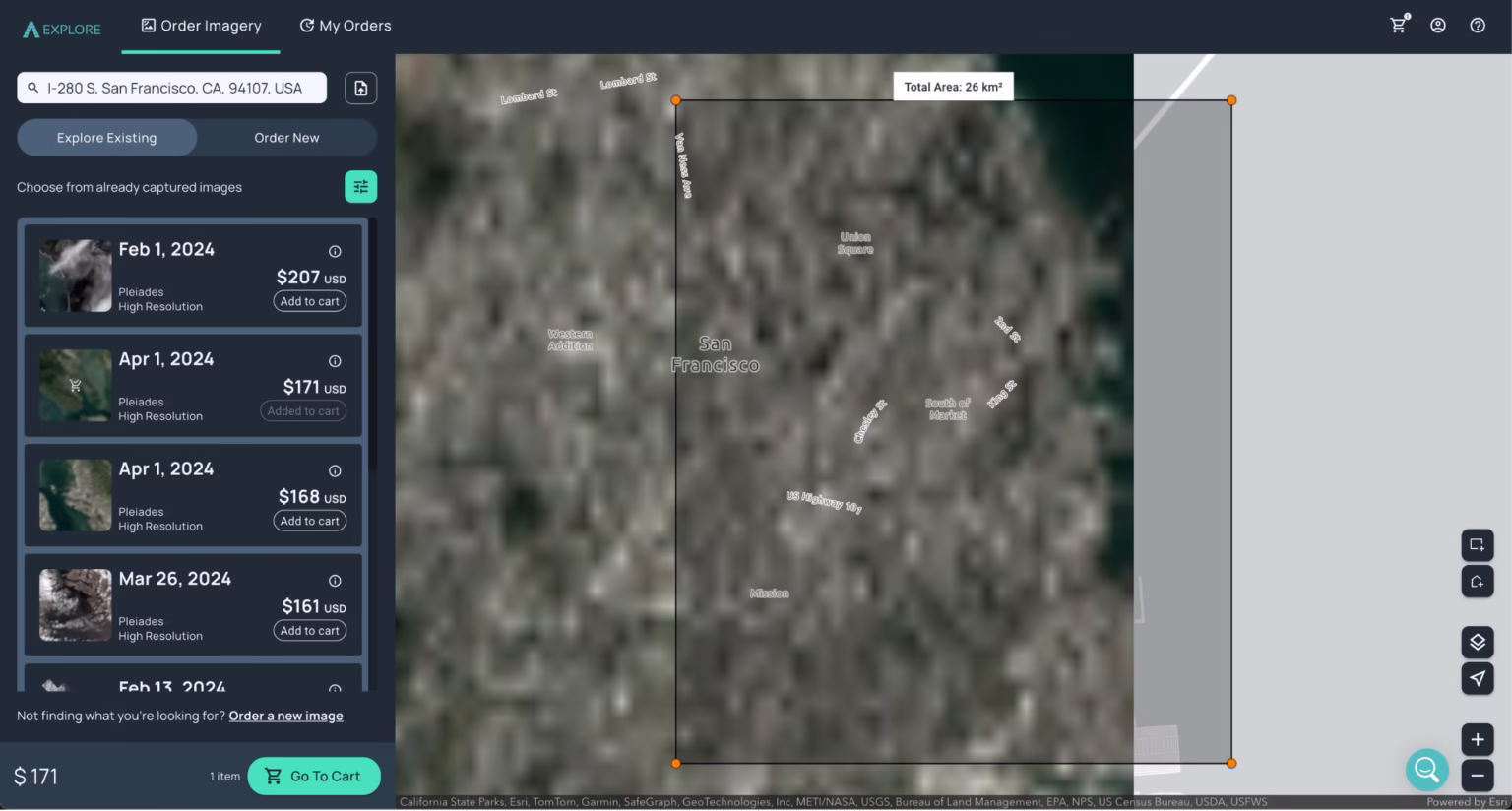
Search any location, preview before you buy
Enter an address or draw your area of interest, then browse results from 15m satellite to 2.8cm drone resolution. Check cloud cover and coverage on every scene, so you only pay for imagery you can actually use.
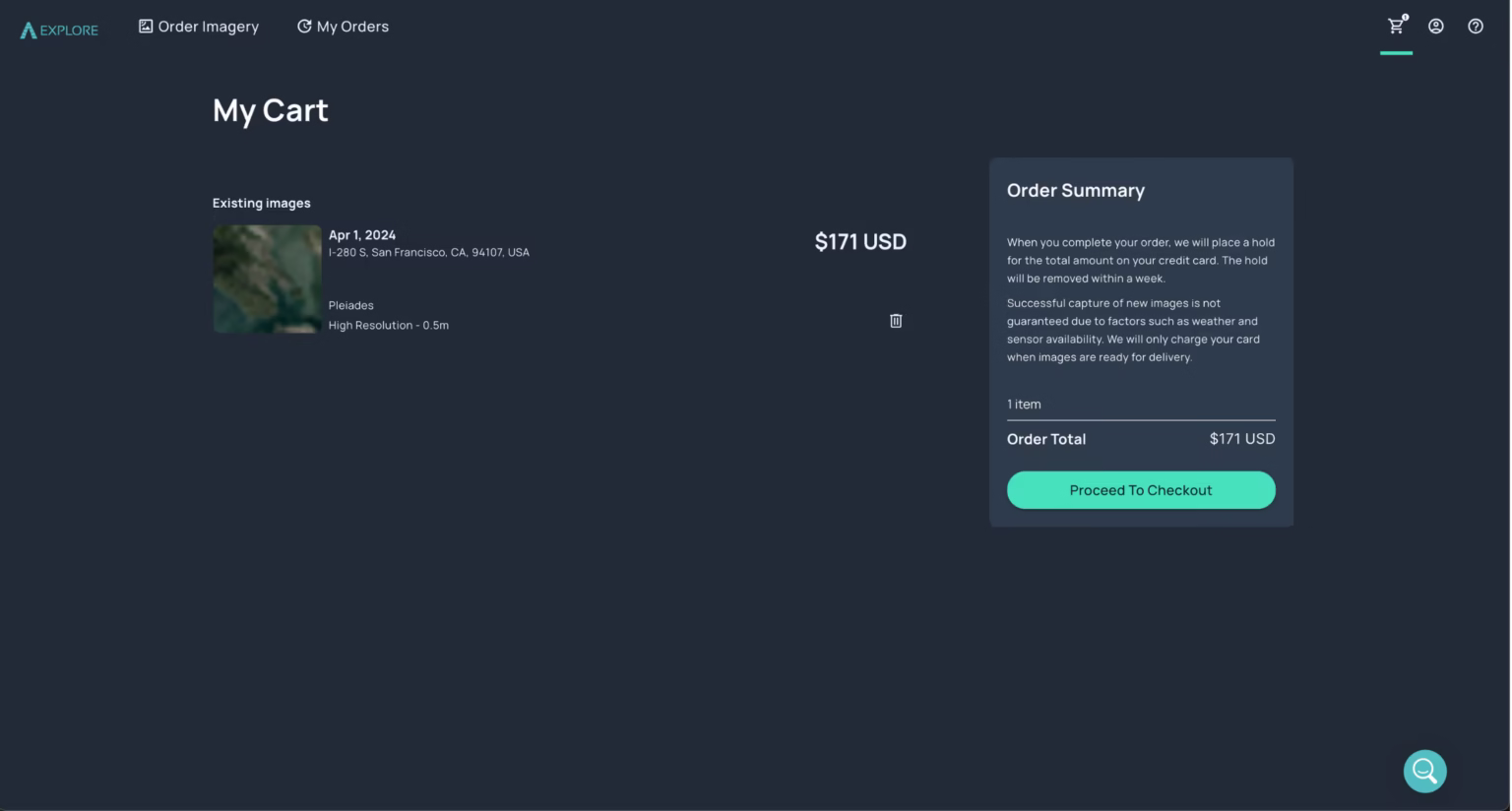
Simple checkout with the price in full view
See full scene details and the maximum price up front — no hidden terms. Create an account and pay securely by card to have your data delivered, all without a sales call.
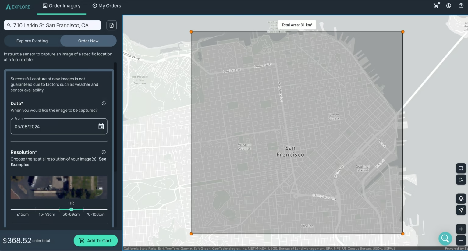
Need a fresh capture? Task a satellite
When the imagery you need doesn't exist yet, order a new capture of your area of interest directly in EXPLORE. Set your parameters and a satellite will collect it for you.
Data partners
Imagery from the world's leading providers
Access an ever-growing network of satellite, aerial, and drone operators — all through a single account.


What will you do with SkyWatch?
Put the planet's data to work. Start searching the world's largest imagery catalog today.