Monitor Pipeline and Energy Infrastructure Without Field Delays
Oil & gas operations span vast, remote, and often hard-to-access environments. From pipelines and well sites to refineries and terminals, maintaining visibility across these assets is critical—but traditional monitoring methods can’t keep up.
Site visits are expensive. Data is fragmented. And delays in visibility lead to delays in decisions.
SkyWatch changes that.
A Unified Platform for Energy Monitoring
SkyWatch gives oil & gas teams a single place to:
Discover imagery across providers
Access satellite, aerial, and (soon) drone imagery from a growing ecosystem without managing multiple vendors.
Purchase and task new data on demand
Order imagery when and where you need it, with transparent pricing and flexible options.
Centralize and manage purchased imagery
Keep historical and current data organized, accessible, and ready for analysis across teams.
Integrate into your existing workflows
Use imagery directly in:
- GIS platforms like ArcGIS
- Internal dashboards and analytics tools
- Automated monitoring systems via API
Use Cases for Oil & Gas Teams
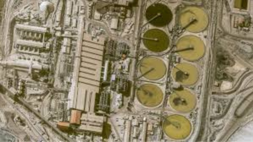
Pipeline monitoring
Detect encroachment, ground movement, and environmental changes across long-distance infrastructure.
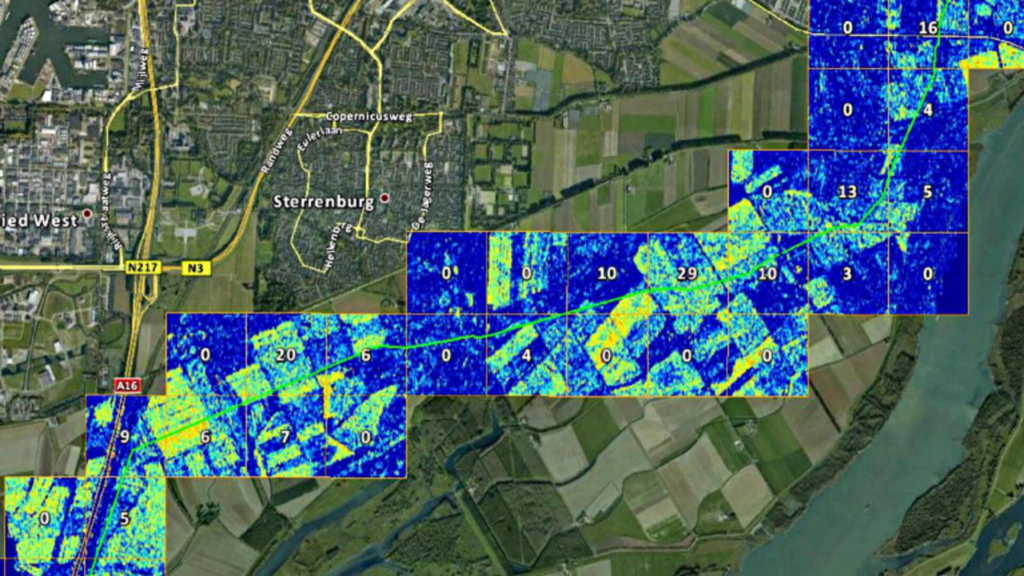
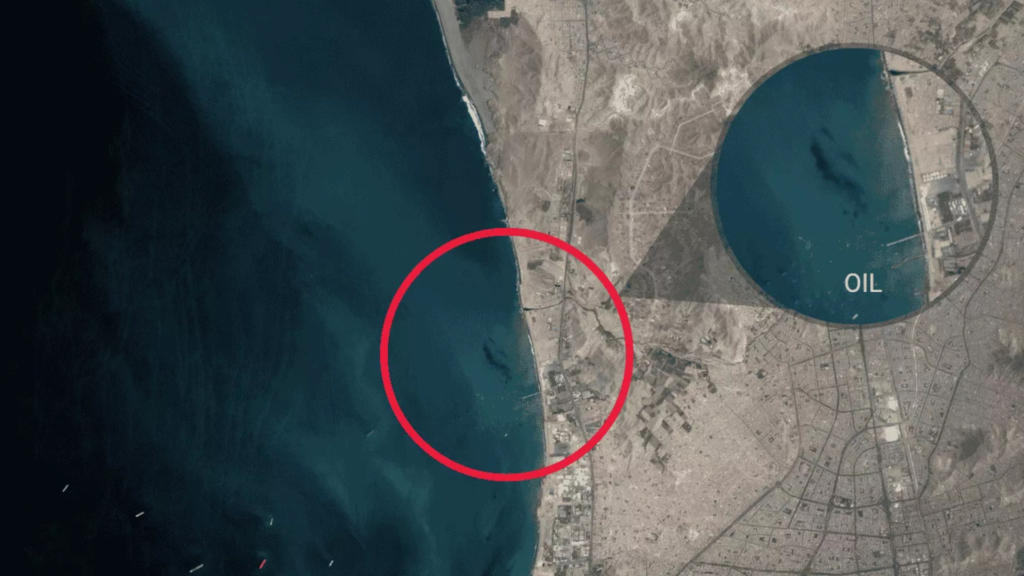
Leak detection & environmental risk
Identify potential issues early by monitoring vegetation stress, soil disturbance, and site conditions over time.
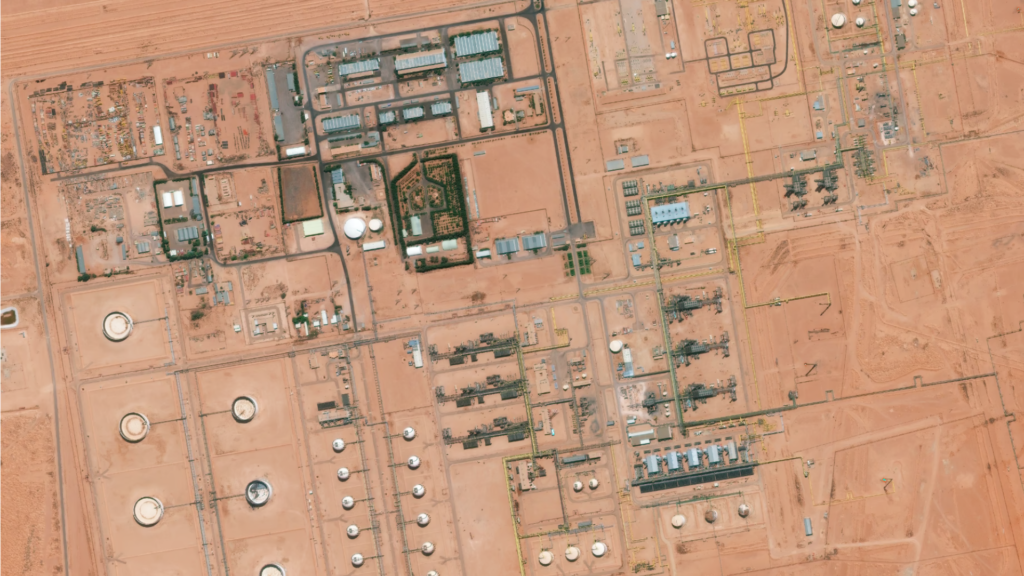
Asset integrity & maintenance
Prioritize inspections by identifying areas of change before sending crews into the field.
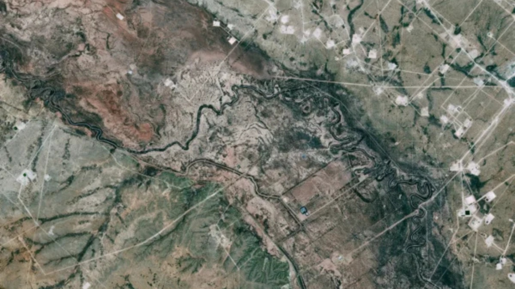
Exploration & site development
Evaluate terrain, monitor site progress, and track infrastructure development across regions.
Regulatory compliance
Maintain a consistent visual record of operations to support reporting and compliance requirements.
Why Energy Teams Choose SkyWatch
- Faster decision-making with immediate access to imagery
- Reduced field costs by minimizing unnecessary site visits
- Improved risk visibility across distributed assets
- Streamlined procurement with one platform instead of many vendors
- Scalable monitoring workflows across regions and teams

Built for How Your Team Works
Whether you’re:
- A GIS analyst working in ArcGIS
- An operations team monitoring assets daily
- A data team building internal tools
- Or an executive looking for better visibility
SkyWatch fits into your workflow, not the other way around.