Field inspections are slow, costly, and risky. Satellite imagery lets enterprises monitor their assets remotely and often, so they catch compliance issues early. This guide covers how it works, the top use cases, and how to get started.
Regulatory compliance is rarely exciting. But for industries like mining, energy, and construction, it may be the most important part of the job. One missed report or unnoticed environmental violation can trigger heavy fines, project shutdowns, or lasting damage to your reputation.
For a long time, monitoring compliance meant sending teams into the field. That work is expensive, slow, and often dangerous. The landscape is changing. More enterprises now use high-resolution satellite imagery to monitor their assets from above — remotely, reliably, and often.
When you build geospatial data into your compliance workflows, you can spot problems before they become violations. That keeps operations running smoothly and safely.
This guide explains three things: how satellite imagery improves compliance monitoring, where it works best across industries, and why it is becoming a standard tool for operational excellence.
The Challenge of Modern Compliance
Site managers and safety officers carry a heavy load. In sectors like energy, oil & gas, or utilities, you may oversee hundreds of miles of pipelines, remote mining sites, or complex urban projects.
Regulators are also getting stricter. They want more frequent reports and higher standards for safety and the environment. Annual audits and occasional site visits no longer cut it. You need eyes on your assets around the clock.
Manual inspections have three clear limits:
- Safety risks: Sending crews to remote or hazardous sites raises the risk of injury.
- High costs: Field teams need travel, equipment, and many hours of labor.
- Data gaps: Occasional visits give you a single snapshot. You can miss violations that happen in between.
Satellite imagery closes these gaps. It offers a safe, steady, and reliable way to monitor large areas.
Key Use Cases: Monitoring From Above
Satellite technology is not just about pretty pictures of Earth. It turns images into data you can act on. Here are four ways enterprises use it to stay compliant.
1. Environmental and Deforestation Tracking
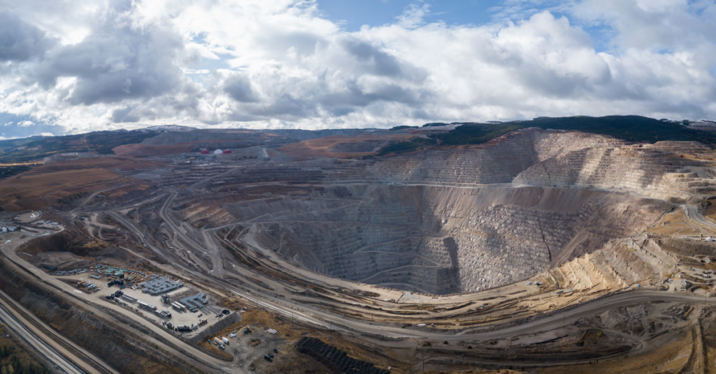
Mining and energy projects face strict environmental rules. Companies must keep operations off protected land and stay within approved clearing limits. Learn more about mining & natural resources monitoring.
High-frequency imagery lets environmental officers track vegetation changes over time. Automated change-detection tools flag any clearing that goes past the permitted zone. Managers can then step in right away — and fix the issue before an audit finds a violation.
2. Emissions and Pollution Control
Newer satellites carry sensors that detect methane leaks and other emissions. For oil & gas teams, this is a major shift. Ground sensors can’t cover every inch of a pipeline. Satellite data gives you a wide view of emission levels instead.
Catching a leak early prevents environmental harm. It also keeps you compliant with tightening emission standards. And it shows regulators and stakeholders that you take safety seriously.
3. Land Use and Zoning Verification
Governments and architecture, engineering, and construction (AEC) firms must keep land use in line with zoning laws. Unauthorized building or land misuse creates legal and safety problems.
Satellite imagery gives you a clear record of land use. Planners can compare current images against zoning maps to spot differences. That speeds up enforcement and keeps projects aligned with city rules.
4. Tailings Dam Stability
In mining, tailings dam stability is a critical safety and compliance issue. A failure can cause massive environmental damage and loss of life.
InSAR (Interferometric Synthetic Aperture Radar) is a satellite technology that detects ground movement down to the millimeter. By watching these structures from space, safety officers can catch small shifts that signal instability. This early warning supports preventive maintenance and protects both workers and the environment.
The Strategic Advantages of Satellite Data
Why invest in satellite imagery for compliance? The benefits go well beyond “following the rules.”
Real-time and historical insight
You get near real-time data, so you don’t wait weeks for a field report. Historical archives also let you look back in time. If a regulator asks when an activity began, you can pull imagery from that exact date to prove compliance.
Cost savings at scale
High-quality imagery has an upfront cost. But it is far cheaper than frequent physical inspections. For utilities watching vegetation along thousands of miles of transmission lines, imagery beats helicopter patrols or ground crews on cost.
Global reach
Many energy and mining sites sit in remote, hard-to-reach areas. Satellite imagery monitors them no matter where they are. Whether your asset is in the desert or deep in the jungle, you get the same clear view you’d have in a city.
Future-Proofing Your Compliance Strategy
Satellite technology is advancing fast. We’re moving toward daily — even hourly — revisits of the same site.
AI and machine learning are making the data easier to read. You won’t need to be a geospatial expert to spot a problem. Smart dashboards will alert safety officers to anomalies on their own, such as a vehicle in a restricted zone or unexpected growth near power lines.
For enterprises that want an edge, building satellite imagery into compliance workflows is a logical next step. It turns compliance from a reactive burden into a proactive strategy.
How to Get Started: Actionable Next Steps
Ready to strengthen your compliance strategy with satellite imagery? Start here:
- Audit your risks. Identify the areas with the highest compliance risk, such as remote pipelines, tailings dams, or construction boundaries.
- Define your data needs. Decide whether you need optical imagery (visual) or radar data (InSAR for ground movement), and how often you need updates.
- Plan for integration. Look for platforms that feed satellite data straight into your existing GIS or asset management tools, so your team adopts it easily.
Take these steps today, and your enterprise will be ready for tomorrow’s regulations. Get started with satellite imagery now.
Frequently Asked Questions
How does satellite imagery support regulatory compliance?
It lets you monitor assets remotely and often. You can track environmental changes, detect emissions, verify land use, and watch structures like tailings dams — catching issues before they become violations.
Which industries benefit most?
Mining, energy, oil & gas, utilities, construction, and government planning teams see the biggest gains, since they manage large or remote sites that are hard to inspect on foot.
Optical or radar imagery — which do I need?
Use optical imagery for visual checks like vegetation or land use. Use radar (InSAR) to measure ground movement, such as shifts in a tailings dam. Many programs use both.
How current is the data?
Many constellations offer near real-time imagery, with revisit rates moving toward daily or even hourly. Historical archives let you review past activity too.