Access Satellite, Aerial, and Drone Imagery Anywhere
Stop switching between imagery providers
Still switching between imagery providers?
That’s not just inefficient. It’s slowing down decisions across your organization.
When imagery is fragmented:
- Insights take longer
- Teams work in silos
- Opportunities get missed
The industry is shifting toward unified, multi-altitude imagery workflows, where data is accessible across the tools and systems teams already use.
What is a unified imagery workflow?
A unified imagery workflow allows organizations to:
- Discover imagery from multiple providers in one place
- Access satellite, aerial, and drone data together
- Use imagery across different environments without friction
Instead of managing disconnected tools and vendors, teams operate from a single access layer that connects imagery to every workflow.
The problem with fragmented imagery access
- Slower decision-making
Teams spend too much time searching for imagery across multiple providers, comparing datasets, and managing access.
- Disconnected workflows
GIS analysts, developers, and business teams often work in separate tools with limited data sharing.
- Underutilized data
When imagery is difficult to access, it gets used less frequently—limiting its value across the organization.
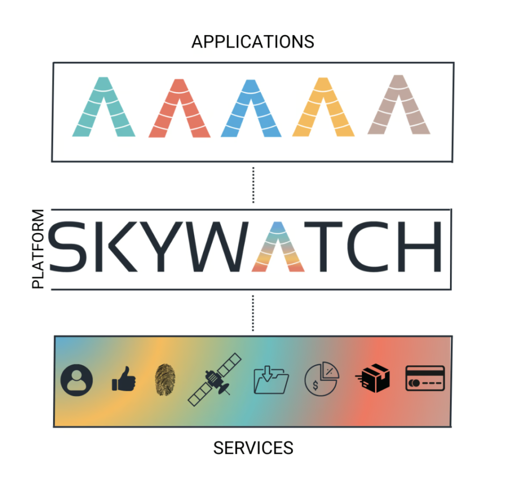
The SkyWatch platform is built to not only provide simple imagery search and access via our EXPLORE and HUB applications, but also to integrate with your existing tools and workflows.
Access and build with imagery APIs
SkyWatch enables organizations to integrate imagery directly into their existing infrastructure, and use it as a foundation for building custom applications.
What this enables:
- Automated imagery discovery and ordering
- Integration into internal dashboards and analytics platforms
- Continuous monitoring workflows powered by imagery
- Scalable access across teams, systems, and applications
Best for:
- Infrastructure monitoring platforms
- Risk and intelligence tools
- Environmental monitoring systems
- Customer-facing geospatial products
Access imagery directly in GIS platforms
SkyWatch integrates with GIS environments like ArcGIS, allowing analysts to work with imagery inside the tools they already use.
What this enables:
- Search imagery coverage within GIS
- Purchase datasets without leaving the platform
- Use imagery immediately in analysis workflows
No exporting. No switching tools. No delays.
Access imagery through AI chat
SkyWatch brings imagery access into modern workflows through integrations with platforms like ChatGPT.
What this enables:
- Discover imagery using natural language
- Quickly explore coverage for areas of interest
- Reduce reliance on specialized tools
This makes geospatial data accessible beyond GIS teams, unlocking value across the organization.
Use cases across industries

AEC
Monitor construction progress, track site changes, and manage infrastructure projects with satellite, aerial, and drone imagery.
Energy & Utilities
Monitor corridors, grid infrastructure, and renewable energy assets.
Insurance & Risk
Assess exposure, verify claims, and monitor catastrophe impacts.
State/Local Government
Support urban planning, infrastructure oversight, and environmental monitoring.
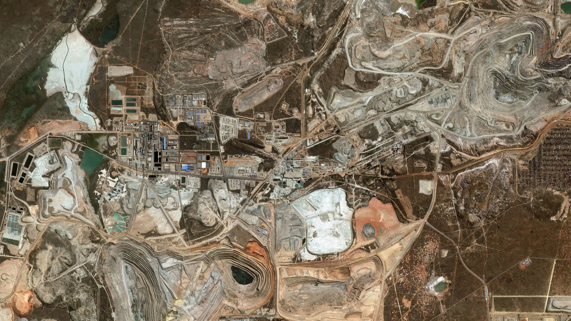
Mining & Resources
Track operational activity, environmental impact, and site development.
The SkyWatch platform
SkyWatch provides a unified platform to:
- Discover imagery from a global provider network
- Purchase and manage datasets in one place
- Access imagery across applications, GIS platforms, APIs, and internal systems
This allows organizations to move from one-off imagery purchases to repeatable, scalable workflows.
Whether you’re:
- Building applications
- Running GIS analysis
- Monitoring assets
- Developing data pipelines
SkyWatch enables you to access and use imagery wherever your work happens.