Improving flood forecasting with Earth observation data is not only possible but it’s been done time and time again. Luca Brocca is a Researcher at the Research Institute of Geo-Hydrological Protection (IRPI) of the National Research Council (CNR), a branch of the Italian government dedicated to monitoring and preventing floods, landslides, droughts, and other water-related natural hazards.
When not working on real-time predictions for the Department of Civil Protection and the local authorities, the Research Institute is working on refining hydrology models to improve forecasting, hoping to mitigate the impact of natural disasters.

MAKING IT RAIN TO IMPROVE FLOOD FORECASTING
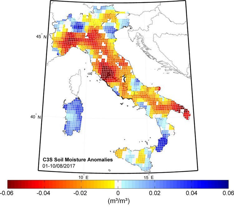
Hydrological models are calibrated using measurements for rainfall, river discharge, soil moisture, and evapotranspiration incorporating estimates of runoff from land cover components. Ten years ago, Brocca and his colleagues started adding Earth observation datasets to their usual ground measurements. By introducing satellite data-derived products into their models, the institute managed to noticeably improve flood forecasting and reduce uncertainty in predictions for stakeholders.
One recent example is the SM2RAIN algorithm the team developed to track precipitations “from the bottom-up”. Past models relied on cloud monitoring, trying to assess the amount of rain particles they carried. The new algorithm, however, uses satellite measurements of soil moisture collected at different times, giving Brocca a more accurate reading on actual precipitations.
This new algorithm can also be easily integrated with other Earth observation-derived products for further analysis. A very important detail since rainfall was not the only measurement Brocca worked to improve.
LOOK IN DEEP WATERS TO IMPROVE FLOOD FORECASTING
River discharge is a variable that is not typically easy to measure from satellites. However, Brocca and his colleagues developed a new model using a combination of optical data from MODIS, to estimate river velocity, and radar altimetry measurements, to assess river levels rising – the same way scientists monitor sea levels rising. Initial tests have shown the new model could accurately predict river discharge in the Niger River up to 5 days ahead. A much-noted improvement over previous models.
Currently, one of the major drawbacks of this new model is the reliance on coarse spatial resolution (250 m), which means discharge in smaller rivers cannot be measured. But Brocca is now looking into adding finer resolution data, such as Sentinel-1 data, into the model.

LOOKING INTO THE FUTURE
Developing new models, and making use of the latest sensor technology, is particularly important as constellations of new satellites are being launched, providing scientists around the world with significant improvements in terms of vertical accuracy and spatial-temporal resolution.
“It is now possible to obtain satellite data at 100 m or even 10 m resolution, which of course changes the number of applications, as we can create studies on a smaller scale. For example, in Italy and in the Mediterranean area, we have a flash flood problem. These types of floods appear in a very short time and only occur on a smaller scale. These new satellite products could help us with that. I am guessing these applications will be available in the next 1,2, or 3 years.” concluded Brocca.
For unique data types to support diverse project needs like this one, check out our EarthCache-X program.


