Application · Construction
Construction & site progress monitoring
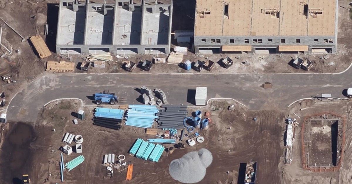
Projects move fast and span sites that are slow to capture from the ground. Overhead imagery gives you a current, measurable view of every site — track progress against plan, verify earthworks, and resolve disputes without a site visit.
In short
Why monitor sites from above?
Scheduled overhead captures replace repeated field visits. Overlay designs on real-world conditions, measure earthwork volumes, document the as-built record, and keep stakeholders aligned with an objective, time-stamped view of progress.
What you can do
From groundbreaking to handover
One platform, repeatable captures, and the right resolution for site-level detail.
Progress vs. plan
Compare each capture against the schedule and design to see exactly what's built and what's behind.
Site surveys & baselines
Establish an accurate pre-construction baseline of terrain and existing conditions.
Earthwork & volumes
Measure cut-and-fill and stockpile volumes from elevation-ready imagery.
As-built documentation
Keep a dated visual record for verification, billing, and dispute resolution.
Change detection
Flag what moved between captures so reviews become exception-based.
Safety & access
Assess site conditions and access remotely, reducing time spent on active sites.
Watch progress accumulate, capture by capture
Set a recurring schedule and each new image stacks onto the last, turning a one-off photo into a living progress record. Pull the results straight into your GIS or project tools for measurement, reporting, and sign-off.
Choosing data
Which imagery for which job?
Aerial and drone give the sharpest site-level detail; satellite adds wide-area context and frequent revisits for large or remote projects.
Compare the options in satellite vs. aerial vs. drone imagery, then see how to buy satellite imagery.
Who uses it
Industries that rely on construction & site progress monitoring
Teams that build use overhead captures to track progress and protect the schedule.
Architecture, Engineering & Construction
Track build progress against plan, measure earthworks, and document the as-built record.
State & Local Government
Monitor public works and capital projects from groundbreaking to handover.
Energy, Oil & Gas
Track construction of plants, pads, and energy facilities on remote sites.
Data partners
Imagery from the world's leading providers
Access an ever-growing network of satellite, aerial, and drone operators — all through a single SkyWatch account.


Keep every project on track
Set your area of interest, choose a revisit schedule, and monitor construction from one platform — with no minimum contract spend.