
The Earth observation (EO) industry is forecasted to grow from a $812 million industry in 2021 to a $2.4 billion industry in 2031 with a 11% CAGR. As more and more satellites enter in orbit, the challenge for users is to attempt to make sense of the data provided. In this new age of Space 4.0 we should only need to know that an image is available in the area we are working in and that it will meet our expectations. These expectations could include the appropriate spatial resolution and cloud coverage. While Space 4.0 needs to be ‘…easily and readily accessible, and built on a foundation of excellence in science and technology – broadly and continuously over time’, so does the data that is delivered to the end user.
This data concept is known as ‘Analysis Ready Data’ (ARD). Having easily accessible ARD has benefits across a range of sectors, whether monitoring major weather events and the potential insurance implications of a flood or assessing the health and extent of the world’s forests. New applications that rely upon this steady stream of unbiased data are being developed today. The energy sector is no different. EO data has been used by oil and gas companies to aid exploration activities for many years and is one of the more mature sectors. EO data has been used within the industry to add value and contextual information to oil and gas operations, aiding risk mitigation and helping make informed yet meaningful decisions.

ENERGY AND RISK
Delays and overruns in projects happen, but being able to reduce them can lead to significant savings. Operational costs, risk mitigation, and environmental disruptions all have to be monitored carefully to meet compliance and streamline operations. While EO data (often combined with other data within a GIS environment) cannot solve every problem, it can provide information that can be used to mitigate risk and reduce the threat of some project overruns. EO data has in the past been used in ‘pockets or silos’ across an organization, for example, to help a geologist to model lithology. There are many components to a project to consider, though. A typical oil and gas project can be broken down into lifecycle stages which can include:
- Pre-License
- Exploration
- Development
- Production
- Decommissioning
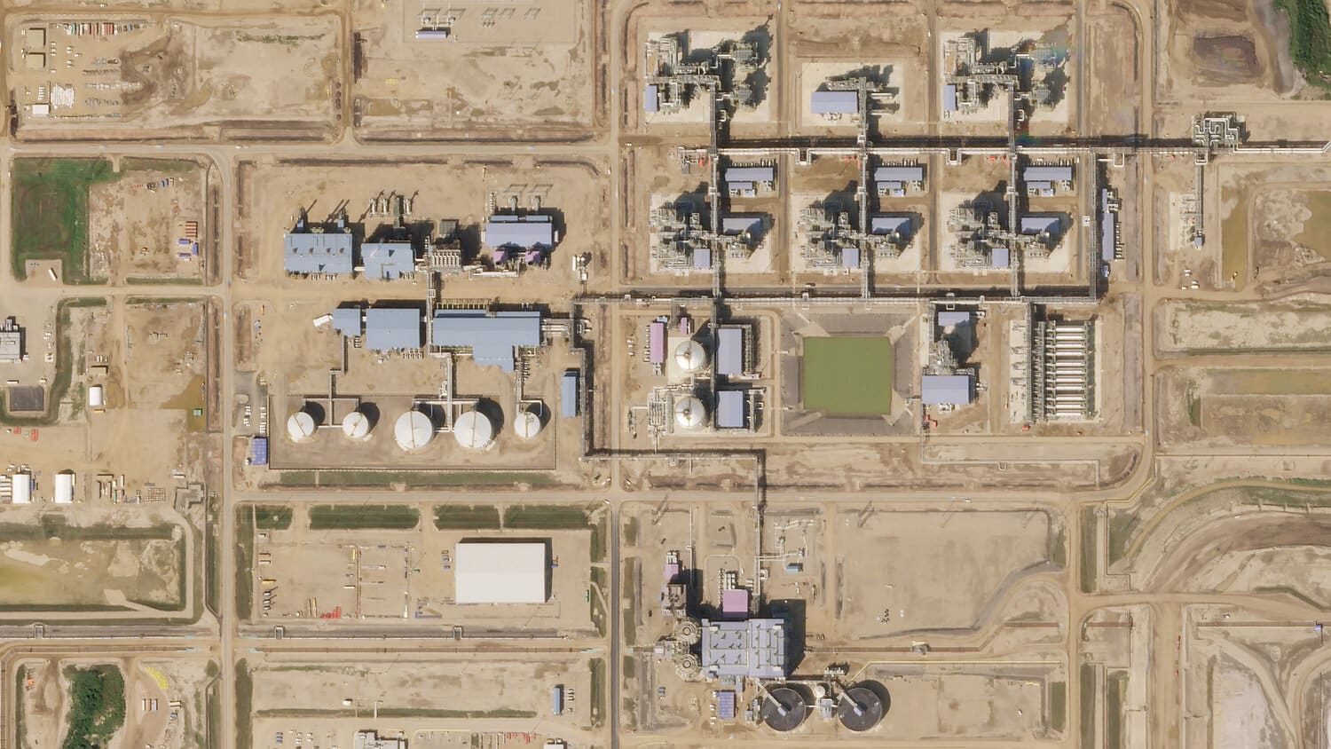
The lifecycle of a well, for example, can span many years. The planning phase can often last more than one year. Well placement needs cross-domain planning expertise, and EO can be a helpful component in providing up-to-date surface information. Once planning is completed, wells can be drilled in two to three weeks and operational after only a few days, going on to produce for several years or even decades. Care is taken to restore the land to its previous condition at several stages, including decommissioning. EO data here provides highly valuable data to quantify restorative efforts. Further information is shown in the following video:
There are clear benefits to this same data being shared with other departments across the lifecycle within an organization, enabling other applications such as planning seismic acquisition logistics and/or modelling a project’s impact on the environment.
EO can help add vital layers of contextual data to support a range of applications, from providing extensive vegetation health metrics to support environmental impact assessments, to simply providing baseline images so analysts can detect changes after an event, such as pipeline encroachment. This information can offer a guide to any remedial work that may need to be undertaken. EO data can support several business units but has traditionally been seen as a more stand-alone data source for one purpose only. It is possible that other departments and senior management level people are not even aware of the presence of this data (which is why we’ve launched EarthCache Enterprise, to facilitate the discovery and sharing of remote sensing data assets within an organization).
BUILDING AN APPLICATION USING EARTHCACHE
Access to EO data shouldn’t be the barrier it once was. Search and discovery of data and preprocessing imagery can significantly lengthen the time it takes to make data-driven decisions. Luckily, EarthCache solves this problem. The data supply chains can be significantly shortened if data pipelines can be built over key operational areas. Machine-to-machine (M2M) data delivery creates this opportunity.
The cost of searching and discovering EO can be a massive barrier to a user. If you are monitoring a pipeline, for example, then the time you might spend looking for data is much better spent analyzing data. Then, using this analysis to decide whether any encroachment requires a field visit, potentially diverting resources immediately or whether the decision to send a team in could be delayed until the next image or report is available. This is all about making smarter, more informed decisions in the shortest possible time with the cost efficiency of obtaining the most appropriate data.
HOW OUR CUSTOMER ORBITAL EYE USES EARTHCACHE TO SUPPORT THE OIL & GAS INDUSTRY
By using satellite data, Orbital Eye, based in Delft, The Netherlands, assists pipeline operators in detecting activities that may damage their pipeline networks.
The biggest cause of damage to pipeline networks is caused by so-called Third Party Interferences (TPIs), such as excavation works, construction-, or digging activities. Traditionally, pipeline operators monitor these TPIs around their extensive pipeline networks through aerial-based surveillance (helicopter or plane), or through car patrol. However, in the last 11 years, Orbital Eye has worked towards improving monitoring procedures for pipeline operators, by offering an innovative, satellite-based solution to monitor these TPIs.
Orbital Eye’s launch of COSMIC-EYE, a satellite-based monitoring solution that provides continuous surveillance capabilities for pipeline operators, was met with increased interest. Its dependability, cost-efficiency and compatibility with sustainability objectives have been instrumental in popularizing the technology. By taking advantage of the uniform quality of satellite data via EarthCache and through AI-driven recognition and filter algorithms, Orbital Eye allows its customer base to identify and assess scenarios that could threaten their infrastructures, aiding in their operations and compliance processes.
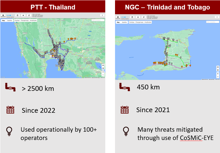
Two pipeline operators (PTT & NGC) demonstrate the benefits of a satellite-based monitoring service provided by Orbital Eye, surpassing conventional methods’ limitations.
- PTT, a pipeline operator based in Thailand, experienced a severe incident in October 2020. In response to this, they partnered with Orbital Eye to upgrade their monitoring capabilities using satellite technologies. Combining radar-, multispectral-, and optical- satellite imagery, has allowed for more frequent and precise detection of anomalies, events and changes along the pipelines. This helps PTT reduce potential risks and reinforces its commitment to achieving the highest safety benchmarks in the industry.
- NGC, a pipeline operator in Trinidad & Tobago, was determined to find an alternative monitoring solution that would be more effective than helicopter patrols. After researching their options, NGC decided to switch to Orbital Eye’s satellite-based monitoring service. This provided them with detailed information about activities around their pipelines and enabled them to take action quickly if potential risks were identified. With the transition, NGC not only improved their risk management but they could also ensure compliance with industry regulations while reaping the cost savings of traditional monitoring methods.
Orbital Eye has greatly helped NGC in improving safety in our pipeline corridor, and satellite-based monitoring has made our monitoring processes much more efficient!
M. Ramroop - The National Gas Company of Trinidad and Tobago (NGC)
SUMMARY
The Earth observation industry is set to grow rapidly in the coming years, and Analysis-Ready Data will be key for many sectors that need reliable and unbiased data. EO data is proven to provide valuable information to manage risk and reduce project overruns within the energy sector, such as oil & gas operations, and companies like Orbital Eye are leveraging this technology with their satellite-based monitoring services, enabling businesses such as PTT and NGC to mitigate risks more efficiently while ensuring compliance with industry regulations. As more applications are developed that rely on ARD, it’s clear that the Earth observation industry will continue its rapid growth trajectory in the near future.

