With some exciting new additions to our roster of leading data providers, SkyWatch is proud to offer the highest concentration of very high resolution geospatial data sources in the world.

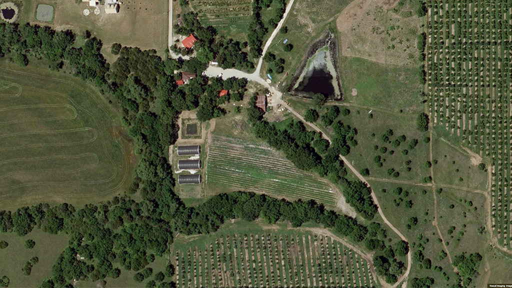
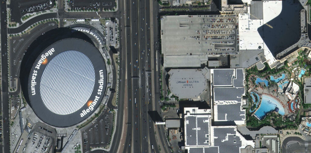
In today’s data-driven world, reliable access to the highest-resolution geospatial data can transform how organizations interact with and understand our planet to make critical business decisions and gain competitive advantage. SkyWatch provides organizations around the globe with unparalleled access to the most very high resolution (VHR) commercially available geospatial data sources, including satellite sources with resolutions as high as 15cm HD, 10cm High Altitude Platform Systems (HAPS) data, and 7.5cm aerial-derived data. Sourcing VHR data from a wide variety of sensor vehicles allows customers the flexibility to prioritize what matters most: scale, economics, and recency.
Enable rich operational insights with VHR geospatial data
Exceptional data precision
The SkyWatch platform offers access to the highest-resolution geospatial data available, capturing fine details that enable a variety of use cases for object detection, machine learning, and visual analysis, at unprecedented scale. This exceptional precision allows for more accurate analysis and informed decision-making, while the resolution enables stakeholders across your organization, even non-GIS experts, to extract valuable insights from the data.
Comprehensive coverage and timeliness
Access an extensive database of historical geospatial data, or task new VHR image captures directly over your desired area of interest for the freshest data available. Whether you need near-real time information or comprehensive historical datasets, the SkyWatch platform ensures you have the highest-resolution data required to make timely, informed, and strategic decisions.
Diverse industry applications
SkyWatch supplies organizations worldwide, across a wide range of industries and applications, with VHR geospatial data, allowing them to remotely monitor high value assets and or remote sites, conduct environmental analyses, derive insurance analytics, plan disaster response, compile media analysis of current events, and track commodities at scale, amongst many other applications. Access to diverse sources of VHR geospatial data unlocks innovation across organizations, and uncovers competitive advantages that were previously unrealized.
Explore more VHR data:
10cm stratospheric balloon imagery:
15cm HD satellite imagery:
Access VHR geospatial data from the world’s leading providers through SkyWatch
Unlock innovation and efficiencies within your organization with VHR data from SkyWatch. Get started at https://explore.skywatch.com or visit https://skywatch.com to learn more about our products and solutions.