- SkyWatch
- For Business Leaders
Get more out of your investment in geospatial data
Unleash innovation in your organization with streamlined access to geospatial data.
New technologies enable innovation, but they can also create new challenges related to control and oversight. As the use of Earth observation data grows within an organization, it’s harder to keep tabs on usage, budgets, permissions, and insights into what data is being used, by whom. SkyWatch makes it easier to provide your teams with access to Earth observation data, while maintaining the controls you need for any business-critical asset.
Trusted by leading organizations

Built for business
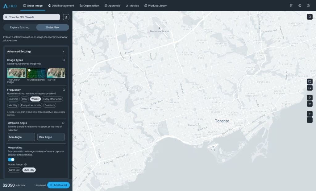
SkyWatch’s user interface is designed with simplicity and efficiency in mind. Navigate seamlessly through features, access critical data in just a few clicks, and empower your team with a platform that’s as easy to use as it is powerful. No steep learning curves; just intuitive design that works for you.
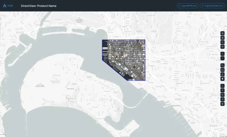
Share imagery effortlessly with your team or stakeholders. With just one click, SkyWatch enables secure, browser-based sharing, eliminating the need for complex software installations. Collaborate in real-time, no matter where your team is located.
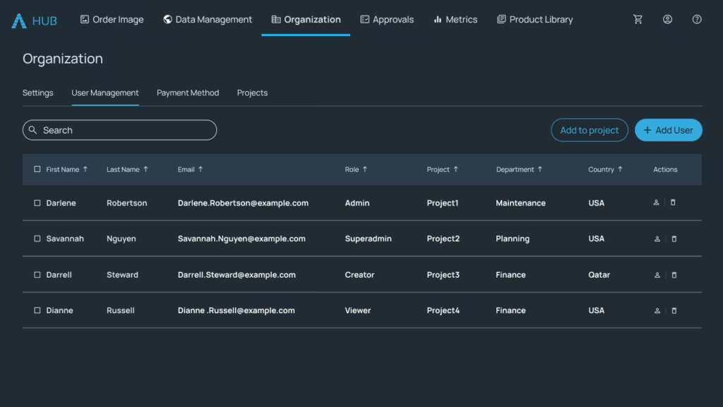
Take control of your resources with SkyWatch’s robust budget and access management tools. Set spending limits, assign permissions, and generate detailed reports by user or group. Stay on top of your operations while ensuring accountability and transparency across your organization.

Our dedicated team of experts is here to ensure your success. From onboarding to ongoing support, SkyWatch provides professional services tailored to your business needs. Whether you need technical assistance or strategic guidance, we’ve got you covered every step of the way.
Products for Business Leaders
SkyWatch HUB allows organizations to maximize their investment in Earth observation data with a centralized hub for data procurement, management, and publishing.

SkyWatch EXPLORE provides an easy-to-use visual interface for discovering and purchasing satellite imagery and other types of Earth observation data.