It can be difficult to picture using satellite imagery in different industries, but Earth Observation is a tool that can be used to help solve problems in our world, no matter how abstract.
Let’s explore how satellite imagery is used in a utility use case.
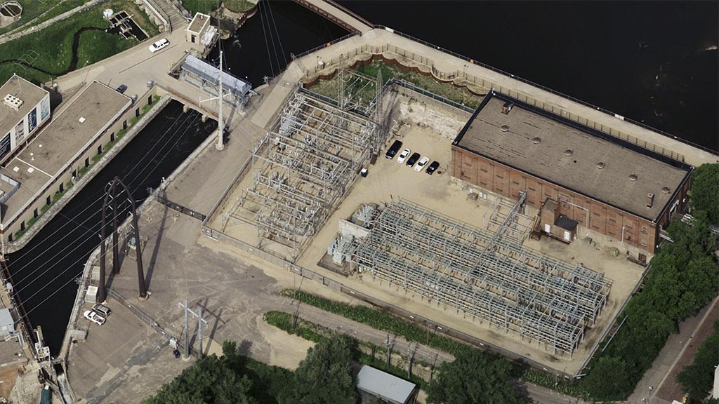
The goal of using satellite imagery in the utility industry is to help monitor assets, vegetation, and third-party interference. Satellite data is a hands-off and detailed method to streamline compliance efforts.
Traditionally, monitoring assets means sending employees to various locations and inspecting sites for quality checks. Continuous monitoring with satellite imagery can limit physical visits, saving the employer time and resources. With medium, high and very high resolution data, organizations can detect a change in an area of interest (AOI) and use AI methods, like tip and cue, to take a closer look at the problem before taking action.
Here are two practical examples of how companies in the utility industry can use satellite imagery.
Electricity
Wires and transformers are vulnerable to third-party interference and can impact their environment if broken or tampered with.
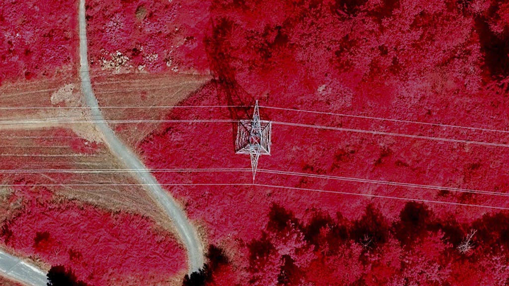
With satellite imagery and a tip and cue method, organizations can continuously monitor vegetation and right-of-ways with free low-resolution imagery. For example, when vegetation height or extent exceeds a threshold value, the maintenance/forestry group will be notified of the problem area. From there, they can cue up high-resolution imagery to get a better idea of what is happening and then decide if it is worth sending out arborists. If arborists are needed to visit a site, they will know exactly where to go and how large of an area they will need to work with. This allows utility operators to be more effective with their workforce and proactive with their right-of-way management. By decreasing the possibility of encroaching vegetation altogether, operators will lessen the likelihood of a power outage, avoiding operational and financial implications.

Monitoring vegetation growth can help electric companies reduce risk by helping them stay on top of maintenance and avoid outages or, worse, wildfires. Using recent imagery can optimize operations. It will help establish where, when and how often vegetation needs to be trimmed back and identify third-party interference without in-person monitoring—saving power producers more time and money. while also increasing their reputation and reliability with clients.
Aside from the savings, consistent satellite monitoring increases reliability with clients. Reliability is key for most utility companies, building your reputation as efficient and trustworthy.
Using satellite imagery to monitor other mechanisms, such as solar panels, explore similar themes:
- Identify all the objects in an AOI you are looking to monitor
- Measuring its environment to detect changes
- Take action quickly when changes are detected
Why not just send someone out to check on these assets in person?
Using satellite imagery over employees to monitor physical spaces reduces risks and costs for the employer. The ability to visit grounds that you know need attention will save costs to get equipment and people out on the field.

Oil & Gas
Underground utilities such as water, oil, and gas often use mapping for underground lines and supportive structures. Satellite data is a cost-effective and detailed method of mapping. Many specialists will use satellite imagery of the desired AOI to map the site and then shift to monitoring practices to monitor the land during construction. If any unplanned changes happen during construction, they can be addressed before further damage is done.
Beyond third-party interference or vegetation, monitoring oil and gas sites can also support compliance efforts.
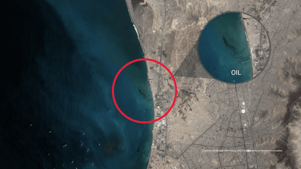
In many industries, oil and gas companies must meet industry safety standards. Remote sensing provides visual proof of compliance efforts and allows the team to take action quickly in the event of a spill.
Monitoring pipelines for spills or leaks can help organizations stay ahead of disasters and protect the environment.
Remote sensing data for the oil and gas industries support:
- Mapping the area for construction to ensure a project is not disrupting a vulnerable environment
- Monitoring pipelines for spills or incidents to take action quickly
- Easy and visual reporting structures for compliance

For other ideas, read our article The potential for Earth Observation to reduce risk in the Oil & Gas industry.
These are just a few examples of how to use remote sensing data in the Utility Industry.
If you’re interested in exploring the world of satellite data, please chat with us.


