Highest Resolution Satellite Imagery: What You Should Know
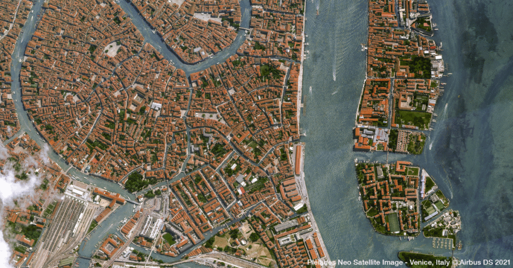
Access to clear, precise geospatial data is completely changing how organizations work. For industries like mining, energy, government, and urban development, the ability to see our planet in amazing detail is a game-changer. Leaders can now make smarter, faster decisions that improve compliance, safety, and operational efficiency. Thanks to incredible advancements in technology, today’s highest […]
A New Perspective: Aerial Imagery Now Available on SkyWatch

At SkyWatch, we’re always working to make the world’s geospatial data more accessible, discoverable, and usable. Today, we’re excited to announce a major step forward: high-resolution aerial imagery is now available on the SkyWatch platform. Through our recently announced collaboration with Eagleview, you can now access premium aerial imagery alongside satellite data. With this new […]
Eagleview and SkyWatch Announce Alliance to Expand Access to Ultra High-Resolution Aerial Imagery
New collaboration brings Eagleview’s industry-leading imagery to the SkyWatch platform, including Esri’s Content Store for ArcGIS, for single image purchases. KITCHENER, Ontario, July 15, 2025 (Newswire.com) – Eagleview, a leading provider of aerial imagery and analytics, and SkyWatch, a leader in remote sensing data technology, today are announcing a new collaboration that makes Eagleview’s ultra high-resolution aerial […]
Enhancing Asset Monitoring in Oil and Gas with Satellite Technology

Enhancing Asset Monitoring in Oil and Gas with Satellite Technology The oil and gas industry relies on vast infrastructure networks, from offshore drilling platforms to pipelines stretching across continents. Ensuring the integrity, safety, and efficiency of assets is paramount to avoiding costly failures, environmental damage, and operational downtime. Traditional monitoring methods, such as manual inspections […]
Drones vs Satellites: What’s Better for Project Site Monitoring?

In the Architecture, Engineering, and Construction (AEC) industry, project site monitoring is critical for maintaining timelines, managing resources, and ensuring regulatory compliance. Remote sensing technologies—particularly drones and satellites—have revolutionized how firms collect and analyze data at various project stages. While drones provide high-resolution, on-demand imagery with exceptional detail, satellite imagery offers broader coverage, consistent historical […]
Remote Sensing for Oil Pipeline Monitoring: What You Need to Know

Oil pipelines are vital conduits for the global energy supply, carrying crude oil and refined products across vast distances. Keeping them intact is a complex challenge: leaks, structural wear, and external threats all pose serious risks. Traditional approaches — on-the-ground inspections and aerial surveys — struggle to deliver real-time insight across sprawling networks. Remote sensing, […]
Solar Farm Site Selection Made Easy with Satellite Intelligence

With the global push towards renewable energy, solar farms have become an essential part of the transition to sustainable power. However, selecting the ideal location for a solar farm is no simple task. Traditional methods rely on extensive field surveys, which can be costly and time-consuming. Thanks to advancements in satellite imagery and geospatial technology, […]
The New Standard in Solar Farm Monitoring: Faster, Safer, Smarter

As solar energy becomes a vital renewable resource, efficient monitoring of solar farms is crucial for maximizing output and sustainability. Traditional methods are challenged by high costs and limitations. Satellite technology enhances monitoring through real-time data analytics, improving efficiency, detecting issues early, and ensuring compliance with environmental standards, driving future innovations in solar management.
Cut Costs and Boost Efficiency in Renewable Energy Site Planning

As the world accelerates its transition to renewable energy, the need for strategic site selection and planning has never been greater. Solar farms, wind farms, and hydroelectric projects require careful consideration of environmental, geographical, and infrastructural factors to maximize efficiency and minimize impact. Traditionally, renewable energy site planning relied on field surveys and ground-based assessments—methods […]
Wind Farm Mapping Tools That Deliver Results

As the world races toward decarbonization, wind energy has become a key pillar of the shift to clean power. Governments are setting aggressive renewable targets, utilities want dependable supply, and wind farms are appearing across coastlines, plains, and mountain ridges. But siting a successful wind project takes more than measuring wind speed. It requires an […]