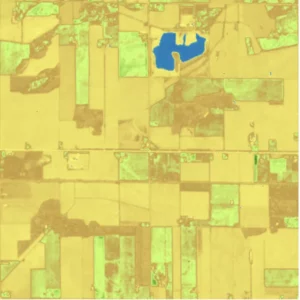
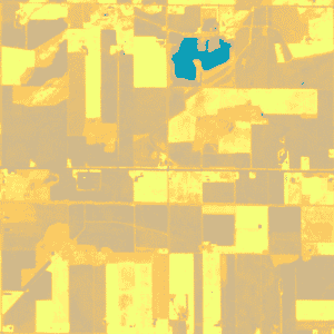
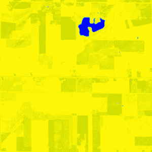
Indices are calculated using the multispectral bands. These calculations result in the outputs being in the form of an index with values between 0-1. At the same time, the indices provide additional information about the ground surface being imaged.
There are four EarthCache outputs that are under the indices umbrella: NDVI, MSAVI2, EVI and NDWI2.
Normalized Difference Vegetation Index (NDVI)
NDVI is used to quantify vegetation greenness. Above all, it is useful in understanding vegetation density and assessing changes in plant health. The image output looks like this:

Enhanced Vegetation Index (EVI)
EVI is similar to Normalized Difference Vegetation Index (NDVI) and can be used to quantify vegetation greenness. However, EVI corrects for some atmospheric conditions and canopy background noise. It is also more sensitive in areas with dense vegetation.

Second Modified Soil Adjusted Vegetation Index (MSAVI2)
MSAVI2 is a radiometric index using the near-infrared and red bands. Its outputs are often used to monitor vegetation cover, biomass, and leaf area index. They can also be used as an input layer for mapping land cover or vegetation classes.

Normalized Difference Water Index (NDWI2)
NDWI2 is a normalized index of the water content in an image. The output NDWI2 can be interpreted similarly to NDVI: the closer to a pixel value of 1, the more likely the pixel is to be water or water-saturated. NDWI2 is calculated by a ratio of the near infrared band and shortwave infrared bands.

When are indices used?
Each of the indices can be useful for different purposes.
NDVI – Often used to assist with vegetation monitoring as it can better detect the health of vegetation when compared to visual analysis. It also is very good at differentiating between vegetated and non-vegetated land. As such it is often used for crop and forest monitoring.
MSAVI2 – Similar to NDVI but better accounts for bare soil. It is often used for vegetation monitoring in areas with more exposed soil or during the early stages of crop development. It can also be used for desertification monitoring.
EVI – Similar to NDVI but is an enhanced index which better accounts for atmospheric interference. It has improved sensitivity over dense canopy which can be very useful for monitoring vegetation changes over heavily forested areas.
NDWI2 – Can be useful for monitoring the changes that occur to waterbodies over time, since it is very good at distinguishing between water, and surrounding land. This can be useful for drought and flood monitoring.
If you would like to expand your knowledge on indices, our article discussing the possibilities of satellite imagery outputs and their practical uses is a great place to start!


