Remote sensing lets us gather information about the Earth’s surface from a distance, and it has reshaped fields from environmental monitoring to urban planning and defense. Like any technology, it comes with trade-offs. Understanding the advantages and disadvantages of remote sensing helps you choose the right data, set realistic expectations, and avoid costly missteps. This guide walks through both sides and the factors that shape how well remote sensing performs in practice.
What Is Remote Sensing?
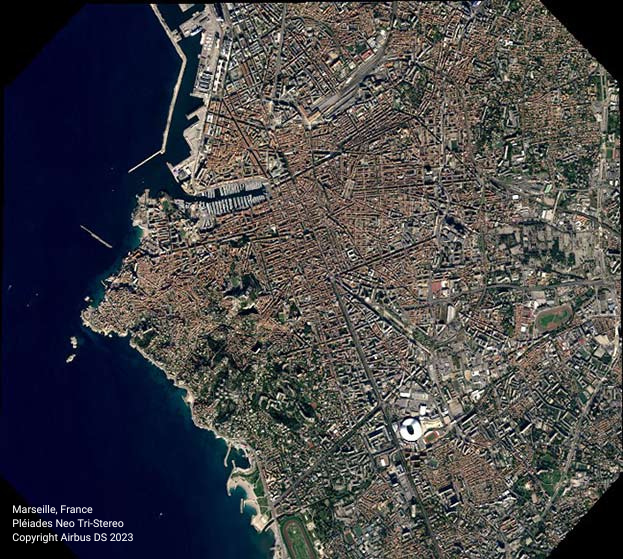
Remote sensing is the practice of measuring energy that an object reflects or emits without making physical contact with it. Sensors mounted on satellites, aircraft, or drones record that energy across parts of the electromagnetic spectrum, and analysts turn those measurements into imagery and insight. Passive sensors rely on an external energy source such as sunlight, while active sensors, including synthetic aperture radar (SAR), emit their own signal and measure what returns.
Advantages of Remote Sensing
Non-intrusive observation
One of the main advantages of remote sensing is that it is non-intrusive. Passive sensors record energy without disturbing the object or area of interest, so researchers can monitor natural phenomena without altering them.
Systematic, repeatable data collection
Remote sensing supports consistent, repeatable measurement that reduces sampling bias. By revisiting the same area over time, you can build comprehensive datasets and track change with confidence.
Rich scientific information
Remote sensing captures a wide range of attributes about the Earth’s surface, including location, elevation, biomass, surface temperature, and moisture content. That breadth lets researchers study environmental processes that would be difficult or impossible to measure on the ground.
Large geographic coverage
Unlike traditional field surveys, remote sensing can cover vast areas efficiently in a single pass. That broad reach is especially valuable for studying large-scale environmental changes and patterns across regions or entire countries.
Diverse sensor technologies
Remote sensing spans many technologies, including optical imagery, LiDAR (Light Detection and Ranging), stereoscopic aerial photography, and radar systems such as SAR and InSAR (Interferometric Synthetic Aperture Radar). This diversity lets you match the sensor to the question, whether you need elevation, all-weather imaging, or fine spectral detail.
Disadvantages of Remote Sensing
Weighing the advantages and disadvantages of remote sensing means being honest about its limits. The following challenges are manageable, but they affect accuracy, cost, and how much you can trust a given dataset.
Human involvement and interpretation
People make decisions at every stage, including choosing resolutions, calibrating sensors, and selecting platforms, and those choices can introduce error or bias. A Geographic Information System (GIS) specialist trained in analyzing geospatial data can reduce these errors. If you do not have one in-house, working closely with a provider’s customer support team can help keep your results sound.
Active sensors can influence what they measure
Passive sensors are physically non-intrusive, but some active systems emit their own electromagnetic energy. In certain situations that emission can interact with the phenomenon under study. For most Earth observation applications this is a minor consideration, but it is worth understanding when you select a sensor type.
Calibration and data quality
Sensors can drift out of calibration over time, which leads to inaccurate readings. Regular calibration and maintenance, along with proper atmospheric correction during processing, are essential to keep data reliable.
Cost and expertise
Analyzing and interpreting remote sensing data takes skill, and skilled analysts represent a real budget line. The imagery itself, however, has become far more accessible. Working with an aggregator like SkyWatch EXPLORE gives you access to leading commercial providers without minimum-spend contracts, so cost scales with what you actually need.

Weighing the Advantages and Disadvantages of Remote Sensing
Remote sensing is a powerful way to gather spatial, spectral, and temporal information about our environment, but it is not a one-size-fits-all solution. The strongest results come from matching the right sensor and resolution to your question, correcting for known sources of error, and pairing the data with informed interpretation. Acknowledge the disadvantages of remote sensing, plan for them, and you can capture nearly all of the upside while keeping your results accurate and defensible.
For help choosing the right data for your project, see the Ultimate Satellite Imagery Guide. When you are ready, you can start exploring geospatial data with SkyWatch EXPLORE and find imagery from hundreds of providers in one place.